Located at a natural chokepoint where the Atlantic Ocean meets the Mediterranean Sea, Gibraltar's strategic maritime location has given this small, 6.7 square kilometre (2.6 square mile) peninsula an outsize influence on history. Created by massive tectonic forces and shaped by wind and water over millions of years, Gibraltar has been home to cave-dwelling Neanderthals, referenced in ancient Roman, Greek, and Phoenician mythology, and fought over by Muslims and Christians, Spaniards and British. It has served as the springboard for the Muslim conquest of the Iberian peninsula, as a walled and fortified city under the Kingdom of Spain, and as a key military outpost and naval base for the British Empire, enduring 14 sieges between 1309 and 1783. It has been sacked by North African pirates in 1540, bombarded into rubble by Franco-Spanish forces in 1782-83, and suffered air raids and midget submarine attacks by Vichy French and Italian forces between 1940 and 1942. It has been a territorial dispute and source of tension between Britain and Spain, who share a 1.2 kilometre (0.75 mile) border along Gibraltar's northern front.
Today, this British Overseas Territory welcomes tourists, including many off of the cruise ships that dock daily, to hike atop its iconic limestone massif and take in the breathtaking views of North Africa and the Costa del Sol from its dizzying heights; meet the famous Barbary macaques living on the Upper Rock; partake in the city's duty free shopping; and tour the abundant historic sites and relics of the peninsula's rich Moorish, Spanish, and British history. Gibraltar's military history is inescapable, with dozens of former artillery batteries, bastions, underground tunnels, and thick stone walls testifying to its status as one of the most heavily fortified places on earth in the 18th, 19th, and early 20th centuries. Indeed, so famous is Gibraltar that several other fortified locations have been nicknamed after it, such as Singapore ('the Gibraltar of the East'), Luxembourg City ('the Gibraltar of the North'), and the Citadel of Brimstone Hill in St Kitt's ('the Gibraltar of the West Indies'). While the military is not nearly as visible in Gibraltar today as it was up to the end of the Second World War, Royal Air Force and Royal Navy units, as well as the locally-raised Royal Gibraltar Regiment, collectively known as British Forces Gibraltar, continue the tradition of a military presence in the territory. With its fascinating history and geography and its Mediterranean climate, this little sun-splashed outpost of Britain in southern Europe is jam-packed with things to see and do.
Before proceeding to our photographic tour of Gibraltar, a brief summary of Gibraltar's history is a useful starting point to set the stage...
Gibraltar's famous Jurassic limestone promontory, reaching a maximum height of 426 metres (1,398 feet), is the result of the northward drift of the African tectonic plate and its collision into Europe between 60 and 20 million years ago. This caused a gigantic tectonic fold that thrust part of the seabed floor upwards, forming the massif. Over time, the effects of wind, rain, and waves eroded and moulded the Rock of Gibraltar into its present shape. The caves eroded into the east side of the Rock by the Mediterranean slowly ascended above sea level as the tectonic plates forced the Rock higher, and it was in these caves that proof was discovered of Gibraltar's original Neanderthal inhabitants. From the Neanderthal bones, stone tools, butchered animal bones, and engravings found in the caves, it has been determined that Neanderthals lived on Gibraltar from around 127,000 years ago to 32,000 years ago, long after they had died out in the rest of Europe. Humans continued to inhabit Gibraltar through the Upper Paleolithic, Neolithic, and Bronze Ages.
Although no evidence exists of permanent human habitation on Gibraltar during ancient times, Phoenician and Carthaginian maritime traders in the Mediterranean used Gibraltar's caves as shrines, leaving behind offerings to their gods in hopes of ensuring safe voyages. Later, the Romans named the Rock 'Mons Calpe' ('hollowed out mountain') and declared it to be one of the two Pillars of Hercules in Greek mythology. According to the Greek legend, Hercules used his superhuman strength to smash through a mountain linking Africa and Europe, thereby connecting the Atlantic and Mediterranean via the Strait of Gibraltar and leaving behind two pillars of rock on either side, the northern one being the Rock of Gibraltar.
Gibraltar saw the arrival of North African Muslims (Berbers) under the command of Tarik ibn-Ziyad in 711 AD. These forces landed at the foot of the Rock, which was given the name Jebel Tarik (Tarik's Mountain) in honour of the Berber commander. Over time 'Jebel Tarik' was corrupted into 'Gibraltar'. Known as Moors in Iberia, the Berber Muslims would go on to conquer much of the Iberian peninsula until they were forced back to North Africa by the Christian Reconquest, completed in 1492. Gibraltar itself remained under Moorish rule until 1462, except for a 24-year period between 1309 and 1333 when it was held by the Kingdom of Castile. During this time, the Moors built extensive infrastructure on Gibraltar, of which the castle, parts of the line wall defences, and a bathhouse survive to this day. The fall of Gibraltar to the forces of the Kingdom of Castile in 1462 put an end to 727 years of Muslim rule and commenced 242 years of Spanish rule of the peninsula. During the period of Spanish rule after 1462, Gibraltar's defences were strengthened with the construction of high stone walls and bastions, especially after a 1540 attack by Turkish pirates via the then-undefended southern approaches to the city. In 1502, Queen Isabella I of Castile granted Gibraltar a coat of arms featuring a castle and key, which still adorns Gibraltar's flag today.
With Spain and Britain on opposing sides during the War of the Spanish Succession (1701-1713), Anglo-Dutch forces mounted an attack on Spanish Gibraltar on 1 August 1704. Four days later, the Spanish Governor of Gibraltar surrendered the city and Spanish troops departed soon thereafter. Nearly all of Gibraltar's Spanish civilian inhabitants also fled rather than swear an oath of allegiance to Archduke Charles of Austria, the contender to the Spanish throne supported by the British and Dutch. Although French and Spanish forces attempted to retake Gibraltar in 1704-05, their efforts failed and, in the 1713 Treaty of Utrecht, Gibraltar was ceded in perpetuity to Great Britain.
Notwithstanding the clear terms of the Treaty of Utrecht, Spain nursed a grudge against what its rulers saw as British occupation of Spanish territory and, in 1779, Spain took advantage of British imperial overstretch during the American Revolutionary War, to declare war on Britain and attempt the recapture of Gibraltar. Although Spanish forces began a siege of Gibraltar on 24 June 1779, it was not until allied French forces arrived in February 1782 that the siege really began to impact the British defenders. As a result of heavy Franco-Spanish bombardment during what became known as the Great Siege of Gibraltar, much of the city was reduced to ruins. (It was during this time that the first tunnels were excavated inside the Rock to create protected artillery positions, commencing a long history of tunnelling in Gibraltar that would eventually result in approximately 55 kilometres of tunnels in a territory measuring less than seven square kilometres in area.) Despite the damage inflicted by the Franco-Spanish forces, the British defenders resisted the siege for three years, seven months, and 12 days, making it the longest siege ever endured by the British Army and the 14th and final siege in Gibraltar's history. The Peace of Paris, signed in 1783, confirmed British control over Gibraltar.
As a strategic outpost of the British Empire, Gibraltar's defences were expanded and strengthened throughout the 18th and 19th centuries. These efforts included the installation of increasingly larger, more powerful long-range coastal defence guns that could hit any vessel transiting through the Strait of Gibraltar. Guns were even mounted high atop the Rock to give them extra range and protect them from enemy counterfire. So extensive were these defences that the territory was known as 'Fortress Gibraltar', one of the most heavily fortified places on earth. Gibraltar's naval base was expanded with dry docks, workshops, and ammunition storage facilities to support the battleships, cruisers, and, later, aircraft carriers comprising the Royal Navy's Atlantic Fleet, homeported in Gibraltar. While Gibraltar's role in the First World War was modest, during the Second World War it was on the frontline of the Battle of the Mediterranean. For their safety, all civilians on Gibraltar except for working-age men were evacuated as far away as Jamaica, Madeira, and Northern Ireland, while the British Army excavated massive underground facilities inside the Rock to house a 16,000-man garrison under expected siege conditions. Nazi Germany did prepare plans to invade Gibraltar through Spain in order to deny British access to the Mediterranean; however, Spain's procrastination, its exorbitant demands for supplies in exchange for supporting the invasion, and the demands of the war against the Soviet Union ultimately derailed the German invasion plan. Italian and Vichy French forces launched ineffectual air raids on Gibraltar between 1940 and 1942, while Italian midget submarines sank several Allied vessels in the Bay of Gibraltar. On the Allied side, Gibraltar played an important role as a launching pad for the Anglo-American invasion of North Africa (Operation Torch) in November 1942, with Supreme Commander Lieutenant General Dwight Eisenhower overseeing the invasion from his headquarters deep inside the Rock. Gibraltar's airport was greatly expanded and its runway extended during the war to accommodate the larger aircraft needed to support the Torch landings.
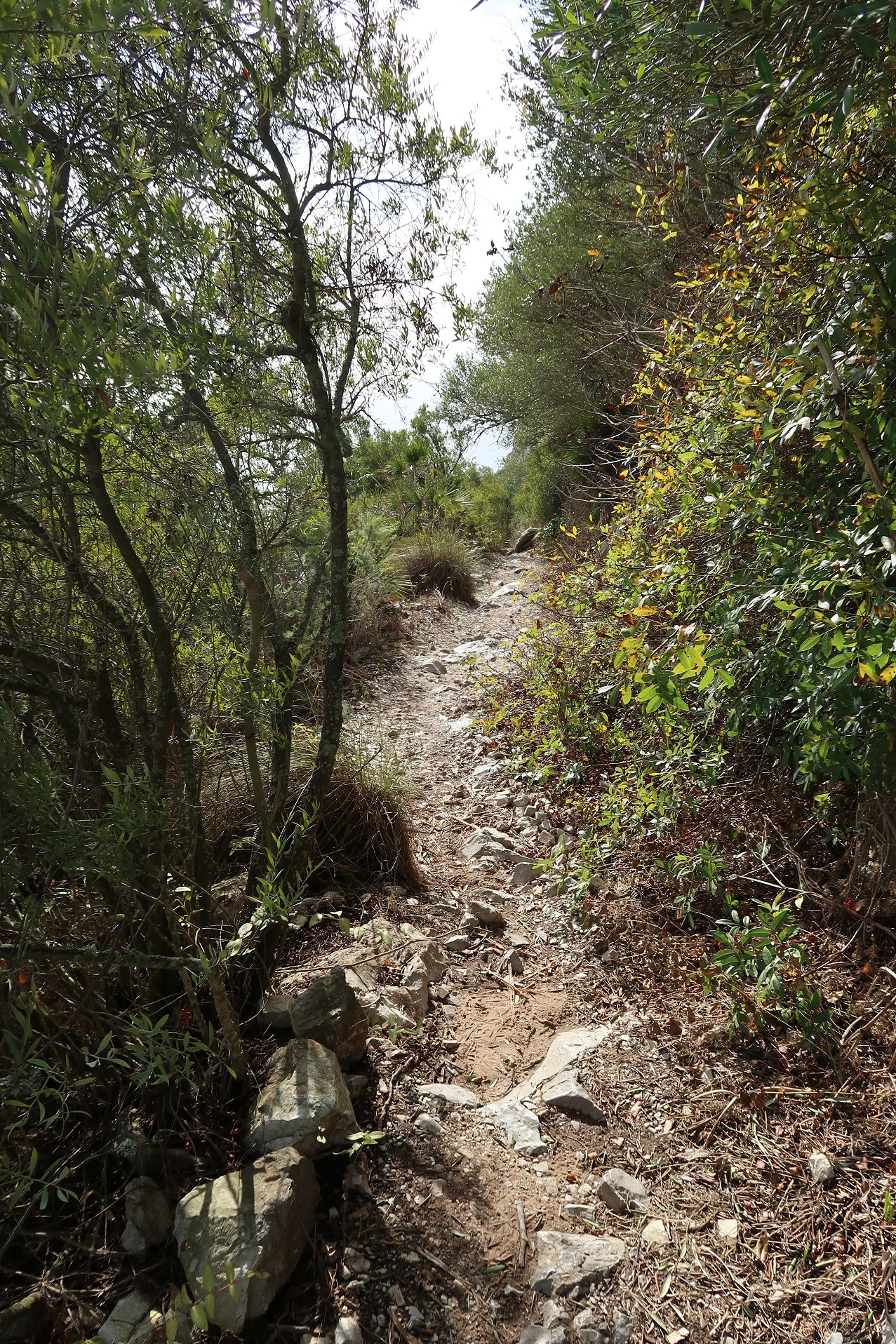
In the post-war period, Gibraltar's military importance declined and many of the resident British units were repatriated to the UK in the 1950s and 1960s. While wishing to remain a British Overseas Territory, Gibraltar steadily gained greater powers of civilian self-governance, with the creation of a Legislative Council in 1950 and a new constitution in 1969 which created a House of Assembly (the Gibraltar Parliament since 2006). Continued Spanish displeasure at British occupation of Gibraltar saw increasingly severe restrictions placed on cross-border trade and movement from 1954 onward. A 1967 referendum that saw an overwhelming majority of Gibraltarians reaffirm their wish to remain British further angered Spain, which closed its airspace to aircraft using Gibraltar's airport and then, in 1969, closed the land border entirely and severed Gibraltar's telecommunications links running through Spain. The border was only fully re-opened in 1985. In the second half of the 20th century, Gibraltar's economy diversified into tourism, marine services, offshore gambling, financial services, and duty free commerce. The Upper Rock, previously off limits as a closed military zone, has been a Nature Reserve since 1993 and is almost entirely accessible to visitors. As Gibraltar's top tourist attraction, the Nature Reserve covers nearly 40 percent of Gibraltar's total land area and features a breathtaking cable car ride, various hiking trails, numerous abandoned military fortifications, a feeding station for Barbary macaques, a castle built by the Moors, extensive military tunnels, a pedestrian suspension bridge over a deep gorge, and an ancient cave filled with spectacular rock formations.
Photos taken 18-23 November 2022
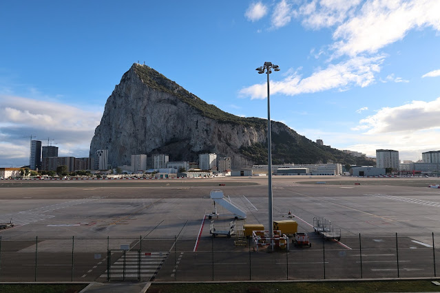
Gibraltar International Airport
 |
| Gibraltar International Airport, as seen from atop the northern heights of the Rock of Gibraltar. The airport property and runway are owned by the UK Ministry of Defence and operated by the Royal Air Force as RAF Gibraltar. The passenger terminal and apron on the airport's north side are operated by local civilian authorities, with EasyJet and British Airways providing regularly-scheduled passenger service. The south side of the airport property houses the military hangar facilities and apron. The runway runs parallel to the Spanish frontier and is bisected by Winston Churchill Avenue, the main road leading to the frontier, which is closed in advance of aircraft landing or departing. |
 |
| Passengers disembark a British Airways A320-200 at Gibraltar International Airport. The north face of the Rock of Gibraltar rises up in the distance, towering over the buildings along Devil's Tower Road. |
 |
| The outdoor observation deck in the Departures lounge of the airport terminal. A lovely location to sit with a cold beverage and enjoy the Mediterranean weather while awaiting your departing flight. |
 |
| Passengers walk out to board a British Airways A320-200 for the scheduled service to London Heathrow. Given the Mediterranean climate and abundant sunshine, the lack of jet bridges to board aircraft directly from the terminal is rarely a problem. |
 |
| With mobile stairs placed at the front and rear doors of the aircraft, passengers can board the aircraft even more quickly. The aircraft seen here, G-EUUL, is an Airbus A320-200 delivered to British Airways on 20 December 2002. |
 |
| A deserted airport tarmac following the departure of an aircraft. Separate from Spain's dispute with the UK over possession of the entire Gibraltar peninsula, Spanish authorities dispute British occupation of the peninsula's isthmus on which the airport sits. Spain claims that British authorities established isolation barracks in the neutral zone of the isthmus during a yellow fever outbreak in Gibraltar in 1815. As such, according to Spanish claims, the land on which the airport currently sits was never ceded to Great Britain under the terms of the 1713 Treaty of Utrecht which ended the War of the Spanish Succession and, amongst other things, ceded Gibraltar to Great Britain. Spanish obstructionism prevented Gibraltar-bound flights from flying over Spanish territory and prohibited direct flights between Gibraltar and EU countries under the Single European Sky program. |
 |
| The Departures lounge. Despite the airport's small size, the Departures lounge contains a restaurant/bar, duty free shop, and several other shops. |
 |
| The main entrance lobby and Arrivals Hall at Gibraltar International Airport, as seen from the publicly-accessible upper floor observation deck overlooking the runway. Bright and sunny, with floor-to-ceiling glass windows, the modern terminal is small but clean and efficient. |
 |
| Another view of the entrance lobby and Arrivals hall in the airport terminal. Airline check-in desks are seen on the left in the background, with an information counter in the centre and rental car desks to the far left. |
 |
| The outdoor observation deck, open to anyone and accessible from the check-in area within the terminal entrance lobby. The observation deck has no seating or shade but does provide a nice view over the runway for plane-spotters. |
 |
| The main entrance to Gibraltar International Airport's passenger terminal. The current 35,000-square metre terminal was built between 2009 and 2011 and opened for service in two phases, in November 2011 and September 2012, respectively. It replaced the first terminal, a 20,000-square metre facility built in 1959 and deemed too small to handle growing passenger numbers by the mid-2000s. |
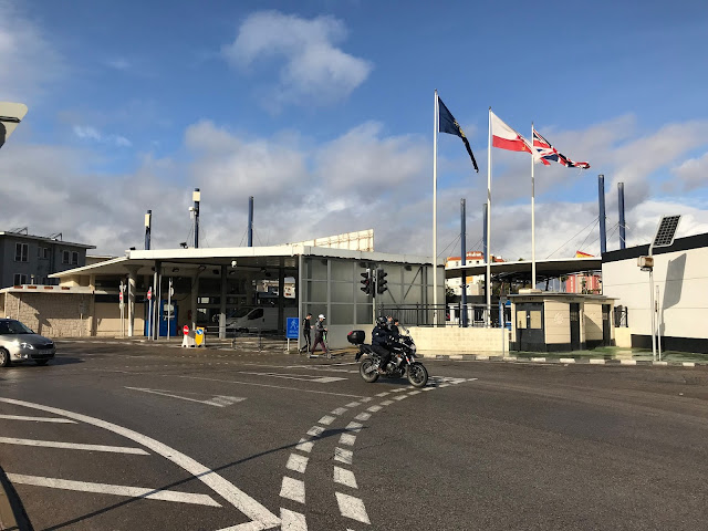 |
| The border crossing from Gibraltar into Spain. Across the border from Gibraltar is the Spanish city of La Línea de la Concepción. A constant stream of personal and commercial vehicles cross the frontier every day, as many of Gibraltar's workers live in Spain due to the cheaper living costs and food and consumer goods are imported. People may also cross the frontier on foot. |
 |
| With a plane due to depart from Gibraltar International Airport, gates close across Winston Churchill Avenue and security guards watch over the growing volume of backed-up vehicles and pedestrians. A sweeper truck will drive back and forth over that portion of the roadway that bisects the airport's runway to pick up any debris dropped by vehicles or pedestrians before the aircraft can depart or land. Only once the plane has safely departed or taxied to the terminal will the gates be raised and vehicle and pedestrian traffic be allowed to resume crossing. |
 |
| Looking north along Winston Churchill Avenue where it commences its crossing of the airport runway. Winston Churchill Avenue is closed several times per day to permit aircraft to arrive or depart, involving a laborious process of stopping traffic to and from the Spanish frontier; this causes long traffic jams until the roadway re-opens. |
A video clip of an EasyJet A320 taking off from Gibraltar International Airport's single runway:
 |
| Gibraltar International Airport's control tower (white building on the left) and passenger terminal, as seen from Winston Churchill Avenue as it crosses the airport runway. |
 |
| Looking west from the centreline of Gibraltar International Airport's single runway. The runway is 1,776 metres (5,827 feet) long and runs across the isthmus connecting the Gibraltar peninsula to Spain. Buffeted by strong cross winds flowing around the Rock of Gibraltar and across the Bay of Gibraltar, landing at the airport can be a bumpy and difficult experience, especially in the winter. From its construction in the Second World War, the airport runway has been successively extended into the Bay of Gibraltar using rock quarried during the construction of military tunnels inside the Rock of Gibraltar. |
 |
| A Royal Air Force Airbus A400M Atlas strategic airlifter parked at the military facilities located on the south side of Gibraltar International Airport. Given its strategically important location at the entrance to the Mediterranean, the British armed forces have maintained a presence at Gibraltar since its capture from Spain in 1704. While no RAF aircraft are permanently based at Gibraltar, many British and Allied aircraft use the airport for exercises or as a stopover on long-distance flights. This A400, ZM407, has made flights between RAF Brize Norton in the UK and places such as Dubai, Bahrain, and RAF Akrotiri in Cyprus. |
.jpg) |
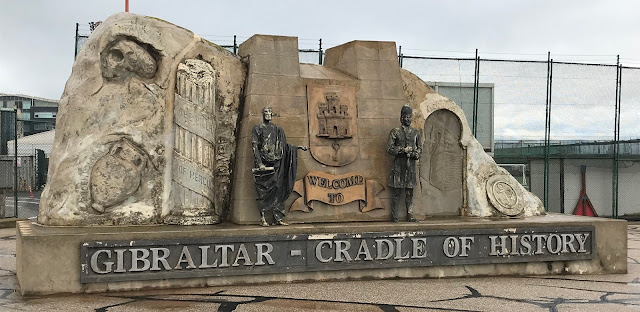
| The Cradle of History monument on Winston Churchill Avenue welcoming visitors to Gibraltar. the monument emphasises the territory's long history, spanning from Neanderthals and Phoenicians to the Moors and, since 1704, the British. |
 |
| The Cross of Sacrifice and Gibraltar War Memorial, located at the intersection of Winston Churchill Avenue and Devil's Tower Road, near the northern end of the peninsula. These monuments honour those sailors, soldiers, and airmen who died in Gibraltar serving the British Empire in the First and Second World Wars. Many were buried at sea, while many others are buried in the nearby North Front Cemetery. The Cross of Sacrifice was unveiled on 11 November 1922 by Gibraltar Governor Sir Horace Lockwood Smith-Dorrien. |
Holiday Inn Express Gibraltar
 |
| A view of the Holiday Inn Express (centre) on Devil's Tower Road, as seen from high atop the northern end of the Rock of Gibraltar. This modern, clean hotel is conveniently located near Gibraltar International Airport and within easy walking distance of the historic old town and the new Ocean Village development. |
 |
| A clean and comfortable single Queen room looking out onto Devil's Tower Road and in the shadow of the Rock of Gibraltar. The room includes a chair and table, television with a wide range of UK channels, in-room safe, coffee/tea service, and en suite bathroom. |
 |
| A panoramic view of the hotel room. |
 |
| The view out the window, dominated by the soaring, sheer limestone face of the Rock of Gibraltar. |
 |
| The modern bathroom decor features a contemporary basin sink and a wall-mounted dispenser for multipurpose soap (hand washing and body wash). |
 |
| The clean, modern shower stall. |
 |
| The in-room coffee/tea service is a godsend after a busy and tiring day sightseeing in Gibraltar. |
 |
| A hearty full English breakfast of scrambled eggs, baked beans, grilled tomatoes, sausage, and bacon, accompanied by juice and tea, is the perfect way to start a long day of sightseeing. The breakfast buffet is included in the room rate at the Holiday Inn Express Gibraltar. |
 |
| A cup of tea and a blueberry muffin rounds out a delicious breakfast before hitting the streets. |
Eastern beaches
 |
| A view of Eastern Beach, as seen from the northern end of the Rock of Gibraltar. Part of a long stretch of sandy coastline spanning Gibraltar and Spain along the Mediterranean, Eastern Beach's northern terminus is the fencing along the Spanish frontier. The beach features soft sand studded with sea shells and smoothed shards of terracotta washed up from the warm waters of the Mediterranean. |
 |
| A deserted Eastern Beach early on the morning of 23 November 2022. The Rock of Gibraltar towers over the beach, with new condominium towers being built in the distance along Devil's Tower Road near the foot of the Rock. |
 |
| Gentle Mediterranean waves roll onto Eastern Beach during the early morning of 23 November 2022. A line of cargo vessels can be seen on the horizon. |
 |
| Looking north along Eastern Beach. The frontier fence dividing Gibraltar and Spain can be seen in the distance. At this time of the morning, only a few dog walkers were encountered on this quiet stretch of beach. |
 |
| The small fishing village of Catalan Bay, located on the eastern side of the Gibraltar peninsula, as seen from atop the Rock. Originally settled by Genoese fishermen in the 17th and 18th centuries, a group of approximately 350 Catalan servicemen who had assisted the Anglo-Dutch capture of Gibraltar from Spain in 1704 settled here after the campaign. However, the settlement had been known as La Caleta ('small cove' or 'small bay' in the Catalan language) prior to the arrival of the Catalans. Most of Catalan Bay's current residents can trace their ancestry back to the original Genoese fisherman. |
 |
| Catalan Bay at night. The beach is the second largest sand beach in Gibraltar (after Eastern Beach) and is often crowded with tourists in the summer months. Aside from its cluster of colourfully-painted homes, Catalan Bay features several seafood restaurants and the Catholic Church of Our Lady of Sorrows. Although a popular swimming beach, Catalan Bay has been known to endure jellyfish concentrations, especially of the mauve stinger. |
North Front Cemetery
 |
| North Front Cemetery, as seen from the northern end of the Rock of Gibraltar. The cemetery is located behind the Holiday Inn Express and abuts the edge of the Gibraltar International Airport. |
 |
| North Front Cemetery was established in 1756 on the low peninsula between the Devil's Tower and neutral ground dividing British-held Gibraltar from Spain. The opening of the cemetery was the result of growing concern over the burial of bodies in the Red Sands area, which was both a military training ground and the main water catchment area for the colony. The threat of epidemic outbreaks required a cemetery well clear of the military garrison and North Front Cemetery met this requirement. Today, North Front Cemetery is the only cemetery in Gibraltar still open for burials. |
 |
| North Front Cemetery was originally divided into five sections, one each for Catholics, Church of England adherents, Presbyterians, Wesleyans, and other denominations. A section for Jews was added in 1848. Today, the cemetery comprises three sections: Christians, Jews, and a smaller unconsecrated section. Although official cemetery records date back to 1868, research efforts have been able to trace some burials back to the beginning of the 1800s. |
 |
| Many of the graves feature elaborate markers depicting crosses, angels, or religious figures. Some are family crypts for multiple members of the same family and other include photos of the deceased. |
 |
| When the Gibraltar airport was built during the Second World War, a section of the cemetery was required and many headstones were moved if family members applied for this to be done. Since the Hebrew faith prohibits disinterment, Jewish graves were left and many now lie under the aircraft parking area. |
 |
| North Front Cemetery was an important military cemetery through both World Wars and is the only Commonwealth War Graves Commission cemetery in Gibraltar. Sailors and soldiers who died on ships passing through Gibraltar or in the colony's military hospitals were buried here, with the graves of 326 First World War servicemen scattered throughout the different sections of the cemetery. During the Second World War, another 360 servicemen were buried in the North Front Cemetery. Most were members of the Gibraltar garrison, though several were officers and men captured in France who escaped to Gibraltar and subsequently died. |
 |
| The grave of Lieutenant General Sir Lothian Nicholson, KCB, a member of the Royal Engineers and Governor and Commander-in-Chief of Gibraltar, who died while in office on 27 June 1893, aged 66. North Front Cemetery is the final resting place for a number of prominent figures, including former Governor of Gibraltar General Sir Kenneth Anderson, KCB, MC (1891-1959); long-time Chief Minister of Gibraltar Sir Joshua Hassan (1919-1997); Victoria Cross winner Thomas Henry Kavanagh (1821-1882); and posthumous George Cross recipient George Campbell Henderson (1910-1951), killed in the explosion of the Royal Fleet Auxiliary vessel Bedenham in Gibraltar on 27 April 1951. |
 |
| Some of the military graves in North Front Cemetery, including a Private of the Dorsetshire Regiment, a crewman on HMS Richard Welford, and a Private of the Cheshire Regiment, all killed in 1916, as well as Signaller Paul William Didsbury of the Royal Corps of Signals, killed on 29 June 2005. |
The City of Gibraltar
 |
| Landport Gate, the entrance to Grand Casemates Square, the larger of two main public squares in Gibraltar. The Landport Gate was once the only landward access point into the city and was heavily fortified and guarded by 20 cannons. Providing additional security was the Inundation in front of the Landport Gate, a flooded and fortified zone measuring approximately 180 metres by 55 metres (590.5 feet by 180 feet) and studded with obstacles. Finally, the Landport Ditch was a moat covering the northern approach to the gate with a drawbridge that would be raised at night and a gunpowder mine which could be detonated beneath any assaulting force. Landport Gate was rebuilt in 1727 after being the scene of bitter fighting in 13 sieges of Gibraltar. |
 |
| Chickens freely roam the approaches to Landport Gate. |
 |
| The southern entrance to the short Landport Tunnel, a pedestrian tunnel leading to Landport Gate at the northern end. |
 |
| Heading towards Grand Casemates Square via another short pedestrian tunnel through the Grand Casemates fortification, completed in 1817. |
 |
| Looking south over Grand Casemates Square, the gateway into Gibraltar's city centre. As a part of the original Moorish settlement named Medinat al-Fath ('the City of Victory'), built in 1160, this area is one of the most ancient parts of Gibraltar. Today lined with shops, restaurants, and bars, Grand Casemates Square is named after the Grand Casemates, the fortified gun emplacement and bombproof barracks structure completed in 1817 at the northern end of the square. While Grand Casemates Square was once used for military parades and public executions (the last hanging of a military serviceman occurred here in 1864), today it hosts open air concerts and National Day celebrations. Grand Casemates Square is the northern terminus of Main Street, Gibraltar's principal commercial thoroughfare, lined with shops and restaurants. |
 |
| The two-storey Grand Casemates building now houses restaurants, bars, and a shopping arcade on the ground floor and shops on the first floor. The restaurants' seating area spills out into the square, one of Gibraltar's most popular tourist destinations. The square was built in 1731 following a series of 13 sieges which destroyed most of the buildings that once stood here. |
 |
| A clearer view of the Grand Casemates building, constructed by the British and completed in 1817. Preparatory work for a bombproof barracks and fortified gun emplacement (casemate) began in 1770 but work did not commence until after the Great Siege of 1779-83, when Spanish and French forces attempted to besiege and defeat the British in Gibraltar. With so many of the local buildings badly damaged by enemy bombardment or intentionally demolished to prevent the spread of fire during the siege, the British decided to tear these down completely and open up the area for a grand public square. |
 |
| An archaeological excavation in Grand Casemates Square. The area now occupied by the square was the site of Gibraltar's first city (the City of Victory), erected in 1160 by the Moorish Muslim ruler Abd al-Mu'min. As part of this city, a port was constructed in what is now Grand Casemates Square, centred on a 40 metre-long galley house in which ships could be built or repaired and then moved into the nearby water. This building was known as La Atarazana, from which the English word 'arsenal' is derived. After the British capture of Gibraltar from Spain in 1704, the Atarazana was converted into a storage facility for gunpowder and cannonballs but abandoned after the Great Siege of 1779-83. The Grand Casemates building was built over the northern half of the galley house. The excavations seen here were uncovered during the refurbishment of the square in 1998 and are believed to be the foundations of the galley house. |
 |
| Grand Casemates Gates, formerly known as Waterport Gate, provided access through the line wall fortifications running along the western shore of Gibraltar. The original Waterport Gate was built in 1727 and provided access to the historic city from the northwest, being the main entrance to Gibraltar in the early days of British occupation. In 1815, two new gateways were opened in the wall at Waterport to permit carriages to pass each other. These are the current Grand Casemates Gates. |
 |
| A #2 bus operated by the Gibraltar Bus Company waits at the Market Place terminus just outside the Grand Casemates Gates. The #2 bus runs nearly the length of Gibraltar, between the Market Place terminus and Europa Point at the southern end of the peninsula. |
 |
| The Imperial Ocean Plaza condominium located at the intersection of Glacis Road, Queensway Road, and Waterport Road. Imperial Ocean Plaza and its three sister residential buildings form part of the Ocean Village development which began construction in 2006. This mixed-use residential-commercial-leisure development features numerous restaurants, bars, two casinos, and the Sunborn Yacht Hotel, as well as berths for 255 boats in the marina. |
 |
| The Waterport roundabout at night, with olive trees decorated with Christmas lights and a bright Christmas lighting display in the fountain at the centre of the roundabout. |
 |
| Heading back to Grand Casemates Square for a stroll down Main Street, the principal commercial throroughfare in Gibraltar's historic city centre. |
 |
| Standing in Grand Casemates Square is a statue of a Gibraltar Defence Force soldier in summer battle dress. the monument commemorates those Gibraltarians who served in the Gibraltar Volunteer Corps, the Gibraltar Defence Force, and the Gibraltar Regiment during the Second World War. It was unveiled by Gibraltar's then-Chief Minister, The Honourable Peter Caruana, on 4 July 1998. |
 |
| Looking north on Main Street, the principal shopping and commercial district in Gibraltar and very popular with tourists and visitors from the many cruise ships that call at Gibraltar. Originally laid out in the 14th century, Main Street's buildings suffered extensive damage and destruction from bombardment by the Franco-Spanish fleet during the Great Siege (1779-83) due to their proximity to the harbour where the bombarding vessels were moored. Main Street's buildings are constructed in a range of architectural styles, including Genoese, Portuguese, Andalusian, Moorish, and British Regency. Most have shops on the ground floor and apartments or offices on the upper floors. |
 |
| A deserted Main Street on the night of 21 November 2022. |
 |
| A nighttime view of the Gibraltar Parliament building, fronting onto Main Street at John Mackintosh Square. Built in 1817 using funds donated by local merchants, the building previously served as the Exchange and Commercial Library, housing a library, auction room, and meeting rooms for the merchants. In 1951 the building was converted into the home of Gibraltar's Legislative Council. With the establishment of a new constitution for Gibraltar in 1969, the Legislative Council became the Legislative Assembly, which was itself renamed the Gibraltar Parliament in 2006 under the newest constitution. |
 |
| The Gibraltar Parliament building during the day. Mounted in a recessed alcove on the front of the building is a bust of General Sir George Don (1756-1832) by sculptor William Grinsell Nicholl. A British Army officer and Acting Governor of Gibraltar between 1814 and 1821 and again from 1825 to 1831, Sir George improved the colony's sanitation system; established the first police force, a new hospital, and the Alameda Botanic Gardens; and updated Gibraltar's defences and its roads to the Spanish hinterland. He died in Gibraltar at age 75 on 17 January 1832. |
 |
| Inside the ground floor entryway to the Gibraltar Parliament building are mosaic tiled depictions of the regimental crests of a number of British Army units that participated in the defence of Gibraltar during the Great Siege of 1779-83. The arches lead out to John Mackintosh Square, located behind the Gibraltar Parliament building. |
 |
| A mosaic tiled crest of the Suffolk Regiment, one of the British Army units which defended the colony during the Great Siege of Gibraltar (1779-83). At that time, the regiment was known as the 12th Regiment of Foot and, later, the 12th (East Suffolk) Regiment of Foot. |
 |
| A mosaic tiled crest of the Essex Regiment, another of the British Army units which defended the colony during the Great Siege of Gibraltar. At that time, the regiment was known as the 56th Regiment of Foot and, later, the 56th (West Essex) Regiment of Foot. |
 |
| A mosaic tiled crest of the Northamptonshire Regiment, another of the British Army units which defended the colony during the Great Siege of Gibraltar. At that time, the regiment was known as the 58th Regiment of Foot and, later, the 58th (Rutlandshire) Regiment of Foot. (As part of British Army reforms of 1881, the 58th (Rutlandshire) Regiment of Foot amalgamated with the 48th (Northamptonshire) Regiment of foot to form the Northamptonshire Regiment. The 'Talavera' battle honour shown on the crest was awarded to the 48th (Northamptonshire) Regiment of Foot for its part in the July 1809 Battle of Talavera, part of the Peninsular War against the forces of Napoleonic France. |
 |
| The rear side of the Gibraltar Parliament building, as seen from John Mackintosh Square. |
 |
| A panoramic view of John Mackintosh Square. Named after local philanthropist John Mackintosh (1865-1940) in 1940, the square is also known to Gibraltarians as La Piazza. It is the second-largest public square in Gibraltar after Grand Casemates Square and has been a centre of public life since the 1300s. Originally called Plaza Mayor or Gran Plaza during the Spanish period (1462-1704), after the 1704 capture of Gibraltar by Anglo-Dutch forces the square was used for military parades and floggings of servicemen for disciplinary infractions. Excavation of the square in 1939 to construct an air raid shelter discovered no traces of any building foundations, suggesting that the site has been a public plaza for its entire 600+ year existence. Today, John Mackintosh Square hosts the annual Gibraltar National Day celebrations on 10 September, marking the date in 1967 when Gibraltarians voted to remain British subjects with institutions of self-government. |
 |
| On the western side of John Mackintosh Square sits Gibraltar City Hall. The building was originally constructed in 1815 as a private residence for prosperous Gibraltar merchant Aaron Cardozo. It was built on the site of the old hospital and chapel of La Santa Misericordia, which has been converted into a debtor's prison by the British after 1704. When completed, the three-storey mansion was the grandest residence ever seen in the colony. As a non-Protestant, Cardozo was not legally allowed to own property in Gibraltar; however, as a friend and vendor to Admiral Horatio Nelson, special dispensation was made for Cardozo and he was granted a building site adjacent to the square on the condition that the residence be 'an ornament' to it. The mansion cost £40,000 to construct and, following Cardozo's death in 1833, the building was rented out as a clubhouse for the Gibraltar Garrison Club until 1839. Between 1839 and 1875, it served as the Club House Hotel. |
 |
| In 1875, the Club House Hotel was bought by businessman and banker Pablo Antonio Larios and refurbished. In 1876, the building was placed at the disposal of the Duke of Connaught, son of Queen Victoria, during his tour of duty in Gibraltar and subsequently named Duke of Connaught House while owned by the Larios family. In 1920, the house was sold by the Larios family to Gibraltar's colonial authorities and used as a post office; however, in 1924 the building was transferred to the new Gibraltar City Council to become the City Hall. Subsequently, a fourth storey and a northern extension were added to the building, altering the building's original symmetry. Council meetings were held here until 1969 when the Council was merged with the Government. |
 |
| Located on the southern side of John Mackintosh Square is a colonnaded Georgian-style building constructed following the Great Siege of 1779-83. Known as the Main Guard, it was from here that all sentries in Gibraltar were dispatched to their posts each evening. The building later housed the Gibraltar Fire Brigade until 1938 and, thereafter, the Rates Office. Today, it houses the offices of the Gibraltar Heritage Trust. |
 |
| The intersection of Irish Town and John Mackintosh Square. The square is the southern terminus of Irish Town, the second most important commercial street in Gibraltar after Main Street. Running north-south one block west of Main Street, Irish Town was known during the Spanish period as Calle de Santa Ana (St Anne's Street) and included a chapel, a monastery, and a convent for nuns. After the British capture of Gibraltar in 1704, the convent was abandoned by the nuns and, in 1720, converted by the Royal Navy into a storehouse and apartments for victualling clerks. The name 'Irish Town' is likely linked to the stationing of an Irish regiment in buildings on the street in the 18th century. Prostitutes servicing the regiment's soldiers led to Irish Town gaining a reputation as a street of ill repute. Although the soldiers and prostitutes were soon superseded by merchants who set up shops and warehouses in Irish Town due to its proximity to the port, the street continued to be called Irish Town. In the early 20th century, Irish Town housed a wide range of commercial enterprises, including tobacco factories, coffee roasteries, and shipping offices. By the late 20th century, the street was pedestrianised and became a tourist hotspot, dotted with many restaurants, bars, and shops. |
.jpg) |
| The former Central Police Station of the Royal Gibraltar Police at the southern end of Irish Town. The red-brick Gothic building was designed by civil engineer Walter Eliot and was inaugurated on 7 July 1864 by then-Governor of Gibraltar General Sir William Codrington. |
 |
| A fish and chips lunch at The Clipper, a nautical-themed pub in Irish Town. |
 |
| Back on Main Street, the Catholic Cathedral of St Mary the Crowned sits at the intersection with Bomb House Lane/Bishop Rapallo's Ramp. Following Spain's reconquest of Gibraltar from the Muslim Moors in 1462, a mosque on this site was reconsecrated as a parish church. As ordered by King Ferdinand II of Aragon and Queen Isabella I of Castile, the old building was demolished and a new Gothic cathedral was built on the site. This new cathedral extended across to the western side of Main Street. Following the British capture of Gibraltar in 1704, British troops ransacked all Catholic churches and institutions in the colony except for St Mary the Crowned, due to the efforts of the cathedral's pastor, curate, and bell-ringer. As a result, St Mary the Crowned is the only place in Gibraltar where Catholic worship has taken place without interruption since the Spanish reconquest in 1462. Severely damaged by bombardment in the Great Siege of 1779-83, the Governor of Gibraltar offered in 1790 to rebuild St Mary the Crowned in exchange for ceding some of the cathedral's property to allow for a straightening of Main Street. This was agreed, with Main Street being rerouted in 1801 and the cathedral being reconstructed in 1810. The cathedral's clock tower was added in 1820 and restoration work was carried out in 1931 to correct the poor workmanship of the 1810 reconstruction. |
 |
| The small courtyard visitors pass through to enter the Cathedral of St Mary the Crowned. This courtyard is the only remaining element of the original mosque that once occupied the site during the period of Muslim rule in Gibraltar that ended with the Spanish reconquest in 1462. The courtyard was originally much larger. The coat of arms of Ferdinand II of Aragon and Isabella I of Castile was installed in the courtyard when the new cathedral was constructed after the reconquest and can still be seen today. |
 |
| The nave inside the Cathedral of St Mary the Crowned, with the altar at the front. During the Spanish occupation, it was common practice for all Roman Catholics to be buried in their church. The bodies were deposited in a deep pit and covered in a layer of lime to hasten decomposition. Many of the oldest grave inscriptions can still be viewed embedded here in the walls of the Cathedral of St Mary the Crowned. The cathedral's bishops are buried in a crypt beneath the statue of Our Lady of Europe. |
 |
| A statue of Christ on the crucifix at the rear of the Cathedral of St Mary the Crowned. Following the 1943 death of Polish Prime Minister-in-exile General Władysław Sikorski in a plane crash in the sea off Gibraltar, his body lay in state in the cathedral before being laid to rest in the Polish War Cemetery in Newark-on-Trent, UK. |
 |
| The only Marks & Spencer department store in Gibraltar is located on Main Street at the intersection with Bomb House Lane. It opened in 1968. |
 |
| The Royal Engineers Monument, standing at the corner of Main Street and Bomb House Lane. It was presented to the people of Gibraltar by the Corps of Royal Engineers and unveiled on 26 March 1994. The statue commemorates the continuous service of the Royal Engineers on the Rock of Gibraltar from 1704 and the formation in Gibraltar in 1772 of the first Body of Soldiers of the Corps, then known as the Company of Soldier Artificers. |
 |
| Looking southwest down Bomb House Lane, one of the many narrow pedestrian laneways snaking off Main Street. Bomb House Lane is notable for housing the Gibraltar National Museum (photos below). |
 |
| The Cathedral of the Holy Trinity, located off Main Street on Cathedral Square. It is the cathedral for the Church of England Diocese of Gibraltar in Europe and is noted for its Moorish Revival architecture, such as the horseshoe-shaped arches and windows along its sides. The cathedral was built at the instigation of Gibraltar Governor John Pitt, Earl of Chatham, who in 1820 persuaded the British government to use the money from the sale of a derelict building to finance the construction of an Anglican church on this site. The construction work between 1820 and 1832 was overseen by Colonel Pilkington of the Royal Engineers. While still incomplete, the building had to be used as an emergency hospital during an epidemic of yellow fever that swept through Gibraltar. Consecrated in 1838, the church was given cathedral status in 1842. |
 |
| A look inside the Cathedral of the Holy Trinity. Interestingly, a small stone from Coventry Cathedral in Coventry, England, badly-damaged during German aerial attacks during the Second World War, is mounted in the wall behind the baptismal font. |
 |
| A closer look at the interior of the Cathedral of the Holy Trinity. When the Royal Fleet Auxiliary vessel Bedenham, carrying depth charges, exploded in Gibraltar harbour on 27 April 1951, it caused significant damage to the cathedral: the roof was blown upwards and all the stained glass windows were shattered. While the side windows were replaced with normal glass, the shards of stained glass were collected and used to fashion the new stained glass windows on the east side of the building, over the high altar. The damage from the explosion was so severe that services could not resume until Christmas 1951. |
 |
| The Bristol Hotel, located on Cathedral Square across the street from the Cathedral of the Holy Trinity. It is named after Frederick Hervey, 4th Earl of Bristol, who travelled extensively throughout Europe. Gibraltar's oldest hotel, the Bristol was built in 1894 and was considered the colony's flagship hotel until the opening of the more lavish Rock Hotel in 1932. It features 60 rooms, a swimming pool, and subtropical garden. During the Second World War, the Bristol Hotel served as the headquarters of No. 200 Group of the Royal Air Force's Coastal Command and also provided accommodations for British officers transiting through Gibraltar on their way to and from the Mediterranean and North African theatres. The hotel entered a period of decline after the war, being seen as austere and cheerless, with various renovations being undertaken during the 1960s to improve the facilities. |
 |
| Duke of Kent House, the home of His Royal Highness Prince Edward Augustus, Duke of Kent and Strathearn, while he was Governor of Gibraltar in 1802. (The official residence of the Governor, the Convent on Main Street, was uninhabitable at this time due to heavy damage suffered during the Great Siege of 1779-83.) The Duke of Kent and Strathearn was the fourth son of King George III and father of the future Queen Victoria. A plaque on Duke of Kent House was unveiled by Edward Augustus's great, great, great grandson, His Royal Highness Prince Edward, The Duke of Kent, on 8 October 1989. The building was originally known as Line Wall House, and was used until recently as Gibraltar Fortress Headquarters. Built as an officers' mess, it was destroyed by bombardment during the Great Siege of Gibraltar (1779-83) and rebuilt again after a fire in 1833. The building was the residence of Prince George, Duke of Cambridge, in 1838, later the residence of the General Officer commanding Gibraltar's Garrison Artillery, and finally the residence of the General Officer commanding the infantry (when it was renamed Fortress Headquarters). Transferred to the Gibraltar government in the 1990s to become part of the Government Secretariat, the building's name was changed back to Duke of Kent House to honour its most famous resident. |
 |
| Looking north up Main Street from outside the Gibraltar Magistrates' Court (on the right). While too narrow for vehicles, Main Street is ideal for strolling on foot or enjoying a meal or drink at an outdoor table operated by one of the many pubs, cafes, and restaurants. |
 |
| The Gibraltar Magistrates' Court, located on Main Street near Governor's Lane. The building is set back from Main Street and fronted by a lush subtropical garden protected by a wrought iron fence. The courthouse was erected in 1820 and originally featured Grecian columns along its front. Note the Royal Coat of Arms on the roof of the building, produced by the Coade Company of London; Coade stone is not actually stone, but rather a very hard-wearing ceramic material that required particular care during manufacture and was used in many prestigious buildings in the early 19th century. Interestingly, the roof's Royal Coat of Arms is different from every other Royal Coat of Arms in the courthouse, as it was installed in 1820 when the coat of arms featured a superimposed central shield to represent the Kingdom of Hanover. This was removed in 1837 following the death of King William IV, as the Salic Law of Succession prevented his successor, Queen Victoria, from ascending the Hanoverian throne. |
 |
| A closer view of the front entrance to the Magistrates' Court. Serving as the Court of Civil Pleas until 1830, on 1 September of that year it became the Supreme Court of Gibraltar following the issue of the Fifth Charter of Justice, Letters Patent, by His Majesty King William IV. In 1888, the building was restored to its present form during the governorship of Sir Arthur Hardinge, who served as Governor of Gibraltar between November 1886 and August 1890. Renovations in 1979 saw the refurbishment of the courtroom and restoration of the gallery floor, as well as the re-plastering of walls, replacement of fixtures and furniture, and the installation of air conditioning. A more extensive modernisation and extension of the courthouse was undertaken in 2010-2011 which, among other work, included the addition of more Supreme Court courtrooms, Magistrates' Courts, and a separate Coroner's Court. |
 |
| Looking toward Main Street from the quiet oasis of the Magistrates' Court's forecourt and garden. |
 |
| The intersection of Main Street and Governor's Lane. Main Street is open to vehicular traffic south of Governor's Lane and pedestrians must be careful to avoid fast-moving cars, trucks, motor scooters, and buses when walking along the narrow curbs. |
 |
| The King's Chapel, connected to the Convent (the official residence of the Governor of Gibraltar). Constructed in 1532 and dedicated to St Francis and St Bernard, this structure was the first purpose-built church in Gibraltar and was originally a Roman Catholic chapel for the adjacent Franciscan friary (the Convent). It was given to the Church of England following the British capture of Gibraltar in 1704. The King's Chapel was badly damaged from bombardment during the Franco-Spanish siege of the colony in 1779-83. While it was restored afterward, the western and southern portions of the church were incorporated into the Governor's residence, becoming a ballroom/music room and staircase, respectively. This smaller King's Chapel was again badly damaged when the Royal Fleet Auxiliary vessel Bedenham exploded in Gibraltar harbour on 27 April 1951, and was once again repaired. Between 1844 and 1900, the King's Chapel was the principal church of the British Army in Gibraltar but, since 1900, has been used by members of the Army, Royal Navy, and Royal Air Force. Catholics also use the King's Chapel for regular services and the building is open to the public on a daily basis. Of note, the date 1560 shown above the entrance likely refers to the date of repairs and the construction of a new bell tower after a raid by Turkish pirates on 10 September 1540. |
 |
| The Convent, the official residence of the Governor of Gibraltar, located near the southern end of Main Street. Originally built in 1531 as a convent for Franciscan friars who arrived in Gibraltar during the rule of Charles I of Spain, the building was used as a residence for the colony's Governor following the 1704 British capture of Gibraltar. In 1728, the Convent was designated as the official residence of the Governor and it has remained in this capacity ever since. Substantial renovations to the building in the 18th and 19th centuries gave it a Georgian architectural style with Victorian elements, including the installation of the covered stone portico in 1867. The Convent's dining room contains an extensive collection of heraldry, while its gardens contain trees planted by King Edward VII, Germany's Kaiser Wilhelm II, Japanese Crown Prince Hirohito, and Queen Elizabeth II. Although the name of the Convent was changed to Government House in 1908 on the orders of King Edward VII, it was King George VI who ordered the restoration of the original name during his visit to Gibraltar in 1943. |
 |
| The Convent Guard House, now serving as the entrance/reception for No. 6 Convent Place, a Gibraltar government building housing the office of the Chief Minister. The Guard House was likely constructed in the early 1700s when the Convent was made the residence of the Governor of Gibraltar, and is still used by the Royal Gibraltar Regiment for the changing of the guard ceremonies conducted in Convent Place. Two 12-pounder brass cannons mounted on carriages and dating from c. 1794 flank the entrance to the Guard House; they are now used for ceremonial duties. |
 |
| The Angry Friar pub on Main Street, across the street from the Convent and next to the Convent Guard House. |
 |
| Located one block to the east of Main Street, at the intersection of Town Range and Convent Place, is Officers Quarters No. III, one of the Town Range Barracks blocks constructed in 1740 to house soldiers, with pavilions at each end for their officers. The former barracks have since been converted to residences and commercial spaces, with one of the buildings housing a school. Along with Main Street and Irish Town, Town Range is one of three principal parallel streets in Gibraltar's old town, and dates back to the Moorish period. It was a notoriously filthy street up until the mid-1800s, due to inadequate sanitation and no running water. It was these unhealthy conditions that led to Town Range being the epicentre of Gibraltar's 1804 yellow fever outbreak, which killed 5,733 people, representing 32 percent of the territory's population at the time. |
 |
| St Jago's Arch, an ornate, carved sandstone doorway from the Roman Catholic Church of Nuestra Señora del Rosario. Although it was originally believed that the doorway had been moved to this site, research carried out by the Gibraltar National Museum in 2013 using records and drawings from the late 16th and early 17th centuries confirmed that this is indeed the original location of the church. Now conserved and restored, this doorway is the only remaining relic of the Church of Nuestra Señora del Rosario. The church's remaining walls were incorporated into the building known as St Jago's Stone Block, built during the British period. |
 |
| Southport Gates at the southern end of Main Street. These gates are part of the Charles V Wall, originally built by the Spanish following an attack by Turkish pirates in September 1540. With no defences on the southern side of the city, the pirates were able to sack and loot with impunity. This led Spanish King Charles V to order the construction of a great stone curtain wall to defend the southern end of the city. These defences were extended to the summit of the Rock of Gibraltar under Charles's successor, Philip II of Spain. The gate on the left was built in 1552 by Italian engineer Giovanni Battista Calvi and formerly known as the Africa Gate. The gate on the right, known as the New Southport Gate, was built in 1883 to accommodate the rising volume of traffic stemming from development outside the old walled city. |
 |
| A 10-inch Rifled Muzzle Loading (RML) Mark II gun, weighing 18 tons, displayed next to the Southport Gates, just inside the old city. This is one of three such 10-inch RML guns originally mounted on the right flank of the nearby South Bastion in 1881. Obsolete and decommissioned less than a decade later, the other two guns were moved to Grand Parade for display while this one was mounted here at the entrance of the Southport Gates. |
 |
| The original Africa Gate built by the Spanish in 1552 included the crest of Holy Roman Emperor and Spanish King Charles V; two wreathed stone pillars (representing the Pillars of Hercules); and two heraldic shields depicting the coat of arms of Gibraltar and the coat of arms of Don Pedro Vélez de Guevara y Manrique, responsible for the defence of the kingdom of Castile and all its territories, including Gibraltar. These carved stone items were removed from the Africa Gate prior to a 19th century renovation and re-mounted, where they remain. |
 |
| Looking south through the Southport Gates. |
 |
| A small park with a statue of Admiral Lord Horatio Nelson located next to the thick walls of the South Bastion. Built by the Spanish in 1540 and known as the Baluarte de Nuestra Señora del Rosario (Bastion of Our Lady of the Rosary), the South Bastion was designed to defend the western end of the Charles V Wall enclosing the south end of the old city. The bastion was improved by the British after the 1704 capture of Gibraltar by an Anglo-Dutch force. Today, Gibraltar College sits atop the South Bastion. The sculpture of Nelson was unveiled on the 200th anniversary of his death in the Battle of Trafalgar (21 October 1805). It depicts Nelson as he appeared during his last visit to Gibraltar and is cast in part from copper taken from Nelson's flagship, HMS Victory, which paid numerous port visits to Gibraltar. |
 |
| With rising volumes of vehicular traffic needing to pass between the old city and newer developments outside the walls, the Referendum Gate was constructed in 1967. This double-wide vehicular gate replaced two earlier, smaller pedestrian gates. It is named in honour of the 1967 Gibraltar referendum in which a majority of Gibraltarians voted overwhelmingly to remain British subjects. |
 |
| The entrance to Trafalgar Cemetery, where members of the British armed forces and their families were buried between 1708 and 1835. (The cemetery was consecrated in June 1798.) Although named after the 21 October 1805 Battle of Trafalgar, in fact there are only two casualties of that battle buried here, with the remaining interments being of those killed in other sea battles or as a result of yellow fever epidemics that swept through Gibraltar in 1804, 1813, and 1814. |
 |
| Proceeding down through a leafy arbour to the cemetery, which sits in a sunken area bounded by the Charles V Wall to the north and the Flat Bastion to the east. The cemetery was formerly known as Southport Ditch Cemetery and occupies a former defensive ditch excavated during the period of Spanish rule. |
 |
| The grave marker for Captain Thomas Norman of the Royal Marine Corps, who died in the Gibraltar Naval Hospital on 6 December 1805, aged 36, as a result of injuries sustained in the Battle of Trafalgar while serving aboard HMS Mars. |
 |
| As a protected graveyard, the Trafalgar Cemetery has developed into a miniature oasis for various species of local and exotic trees and plants. Some of the tree species growing in the cemetery include the European olive, bluegum eucalyptus, the Mediterranean cyprus, almond, Chinese parasol tree, Wollemi pine, spiked cabbage tree, and American red oak. Additionally, a wide range of animals, birds, and insects live in the cemetery, including geckos, Iberian wall lizards, bats, and funnel web spiders, as well as monarch butterflies who feed on the milkweed plants growing here during their migratory passages. |
 |
| An anchor donated by the Royal Navy tops the Battle of Trafalgar memorial. The stone plaque quotes the message sent by Vice Admiral Cuthbert Collingwood to Henry Edward Fox, Governor of Gibraltar, on 22 October 1805 announcing both the British victory in the Battle of Trafalgar and the death of Admiral Lord Horatio Nelson in that battle. |
 |
| Buried here are many Royal Navy sailors who died of wounds received during naval actions off Algeciras on 6 July 1801, Trafalgar on 21 October 1805, Cadiz on 23 November 1810, and Malaga on 29 April 1812. Some other graves date from 1798. Those killed during the naval battles were generally buried at sea, but injured sailors were brought to Gibraltar for medical care and were buried here if they succumbed to their injuries. |
 |
| The Trafalgar Cemetery is maintained by the Gibraltar Heritage Trust and was renovated in the late 1980s with financial assistance from Trafalgar House Plc and its subsidiary, the Cunard Steamship Company. The cemetery does not accept new burials and had been abandoned for many years before it was refurbished. |
 |
| The grave marker of Lieutenant William Forster of HMS Colossus, who died at the age of 20 from wounds sustained in the Battle of Trafalgar. |
 |
| The headquarters of the Gibraltar Fire & Rescue Service, located at 5 Red Sands Road, across from the Alameda botanic gardens. The Art Deco building was completed in 1937-38. |
 |
| A Gibraltar Fire & Rescue Service Land Rover Defender pick-up truck parked in front of the fire station on Red Sands Road. |
 |
| Perched above the harbour and town on Europa Road is the Rock Hotel, built in 1932 by John Crichton-Stuart, 4th Marquess of Bute. As Gibraltar's most famous hotel, the Rock Hotel has played host to numerous celebrities and high profile guests, including Sean Connery and his wife Diane Cilento following their marriage in Gibraltar in 1962. The Art Deco hotel is situated on an 8.9-acre landscaped property and features 104 rooms. During the Second World War, many military officials stayed at the Rock Hotel when in Gibraltar, enduring the noise caused by work to excavate defence tunnels in the Rock of Gibraltar using dynamite and heavy equipment. |
 |
| The Ocean Village Marina, located in the Bay of Gibraltar, just south of the airport runway in the city's North District. The marina can accommodate 255 boats, including super yachts up to 100 metres (330 feet) in length. |
 |
| Another view of Ocean Village Marina, with the Sunborn Gibraltar Yacht Hotel in the background. The Sunborn Gibraltar is a five-star hotel and casino permanently moored in Ocean Village, and features sun decks with plunge pool, spa, gym, and spacious guest rooms and suites with private terraces. Onboard dining options include the fine-dining Barbary Restaurant (Mediterranean/North African fusion cuisine), La Sala Restaurant & Bar (Asian and Latin cuisine), the poolside Aqua Bar, and the elegant Sapphire Bar. Sunborn Gibraltar was built as an ocean-going luxury vessel but never sailed as she was acquired by the Sunborn Group as the world's first five-star luxury yacht hotel and installed in Gibraltar. |
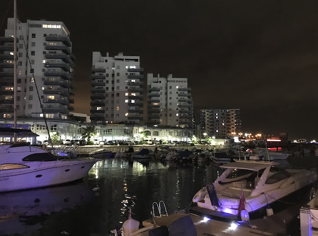 |
| Nighttime at Ocean Village Marine. The residential towers of the Watergardens apartment complex line the southern edge of the marina. |
 |
| A quiet late night dinner at the Pizza Express in Ocean Village. The restaurant is situated on one of three triangular piers in the marina, on which are located various restaurants and bars. Even in late November, the pleasant temperatures and gentle breezes in Gibraltar permitted outdoor dining in perfect comfort. |
 |
| A thin-crust Padana pizza (goat’s cheese, caramelised onions, spinach, red onions & garlic oil, mozzarella, tomato sauce) and an orange Fanta. |
 |
| To round out a lovely meal, a pot of tea and a tiramisu (coffee, cocoa cream, mascarpone, marsala wine, sponge fingers) for dessert at Pizza Express. |
.jpg) |
| The former Montagu Sea Bathing Pavilion on Queensway Road. Constructed in 1929-30, the building was opened by His Excellency General Sir Alexander Godley, Governor and Commander-in-Chief of Gibraltar, on 15 May 1930. The pavilion originally comprised a main entrance hall leading to separate changing rooms for men and women and divided into 100 cubicles per wing, with two large salt water pools and two smaller salt water pools for children. Queensway Road is built on reclaimed land and runs north-south just west of Line Wall Curtain, Gibraltar's main city wall. |
 |
| The American War Memorial, also known as American Steps, located near the northern end of Line Wall Road and incorporated into the Line Wall Curtain, the city's main defensive wall. The memorial was built in 1932-33 for the American Battle Monuments Commission and inaugurated in October 1937 to commemorate the achievements and comradeship of the American and British navies in the vicinity of Gibraltar during the First World War. The masonry arch, built from dolomitic limestone quarried from the Rock of Gibraltar, sits at the top of a set of steep steps running down to Reclamation Road, Fish Market Lane, and Queensway Road. On 7 November 1998, the Gibraltar-American Council installed a bronze plaque on the American War Memorial to commemorate the anniversary of Operation Torch, the Anglo-American invasion of North Africa on 8 November 1942. |
 |
| Steps from the American War Memorial is Orange Bastion, once part of the city's defences against enemy attack from the Bay of Gibraltar. Now converted into a multi-purpose space for exhibitions, in November 2022 it was hosting a display telling the history of Operation Torch, the Anglo-American landings in Vichy French-controlled Morocco and Algeria on 8 November 1942. |
 |
| The Operation Torch exhibition tells the story of the planning, training for, and execution of the Anglo-American landings in French Morocco and French Algeria in November 1942. The Torch landings were the first major combined combat operation of the Second World War involving American and British forces. The ground forces comprised 107,000 troops, supported by 350 Allied warships and 500 Allied transport vessels. Lieutenant General Dwight Eisenhower was appointed Supreme Commander for Operation Torch and set up his headquarters in Fortress Gibraltar, planning the invasion from a boardroom deep within the Rock of Gibraltar and immune from any bombs. |
 |
| Looking north along the esplanade on Line Wall Road near John Mackintosh Square, the site of the Gibraltar War Memorial. This esplanade and the steps which link it to Reclamation Road below were constructed in 1921 during the tenure of Governor Sir Horace Lockwood Smith-Dorrien. |
 |
| The Gibraltar War Memorial, also known as the British War Memorial, unveiled by Gibraltar Governor Sir Charles Monro on 27 September 1923. The memorial is crafted from Carrara marble and commemorates those killed in the First World War. The plaque reads 'To the Memory of all Officers and Seamen of the Gibraltar Straits Patrol Who Gave Their Lives for Their King and Empire in the Great War'. Near the memorial sit two Russian guns captured by British forces in 1854-56 during the Crimean War, and gifted to the city of Gibraltar in 1858 in recognition of the valuable assistance given by the people of Gibraltar to Britain and its armed forces during the war. |
 |
| Across Line Wall Road from the King's Bastion Leisure Centre is the Casino Calpe, Gibraltar's oldest civilian club, founded in November 1853. |
 |
| King's Bastion, one of the many fortifications along the Line Curtain Wall enclosing Gibraltar's old city and built to defend against attack from the Bay of Gibraltar. Built in 1773, the King's Bastion was designed in the shape of an arrowhead and extended from the Line Curtain Wall into the Bay of Gibraltar. Housing 800 soldiers, it was the most important of Gibraltar's westward defences, playing a critical role in defending the colony during the Great Siege of 1779-83. It was from here that Gibraltar's Governor, General George Augustus Eliott, commanded the defence of the colony against attacks by Franco-Spanish forces. Guns mounted in King's Bastion fired heated cannonballs which set alight the Spanish floating batteries that were causing massive damage to the city. Another Governor, Sir Robert Boyd, was buried in King's Bastion in 1794 at his request. Between 1961 and the early 1990s, the King's Bastion served as an electricity generating station. After extensive refurbishment and restoration, the King's Bastion reopened as a leisure centre in 2008, housing an ice skating rink, cinemas, bowling lanes, arcade games, a gym, outdoor dining facilities, a youth lounge, and a nightclub. |
 |
| South of, and adjacent to, the King's Bastion Leisure Centre is Commonwealth Park. Completed in 2014, Commonwealth Park is the first public park in Gibraltar's urban core, covering 2.5 acres. The 3,000 cubic metres of top soil used in the park was manufactured in Gibraltar using recycled soil from local and reclamation areas. |
 |
| Formerly a parking lot, Commonwealth Park features Mediterranean-style ornamental planting beds, 143 trees, a broad lawn, water fountains, sculptures, pathways, a bandstand, and an artificial lake traversed by a bridge. The park is bounded by the old defensive line wall on its eastern side and by the Wellington Front Right (North) Bastion on its south. |
 |
| The Nefusot Yehudah ('The Dispersed of Judah') Synagogue, also known as the Flemish Synagogue, located at 14 Bomb House Lane, at the intersection with Line Wall Road and across from the King's Bastion Leisure Centre. Opened in 1799 or 1800, this synagogue was founded by members of Gibraltar's Jewish community concerned by the growing dominance of Moroccan Jewish traditions in the colony's Great Synagogue. They therefore raised the money to build the Nefusot Yehudah Synagogue, which would adhere to the more formal Dutch customs. Although the interior of the synagogue was destroyed by fire in 1913, it was reconstructed to designs by an Italian architect more familiar with the architecture of Catholic churches. The consequence was that the Nefusot Yehudah emerged from its reconstruction with a beige, Dutch exterior and an Italian interior featuring marble and a reading desk incorporated into the ark for the Torah instead of being centred in the middle of the building. Further renovations after 1945 included the addition of Moroccan tiles in the interior. The sole remnant of the original garden around which the Nefusot Yehudah was built is a single palm tree in the courtyard. |
 |
| Queensway Quay Marina, one of three marinas in Gibraltar. Built in the middle section of Gibraltar Harbour, Queensway Quay Marina occupies what is believed to be the oldest wharf in the city, Ragged Staff Wharf, dating to Spanish times and developed by the British in 1736. The Queensway Quay Marina opened between 1992 and 1994 and has berths for 156 boats. Apartments and homes ring the marina, with restaurants, bars, and shops on the ground floor of the main complex, seen in the background. |
 |
| Mediterranean-style townhouses in the Queensway Quay development. Built on a former Ministry of Defence site in the 1990s, these residences were one of the phases of the development of Ragged Staff Wharf, which included Queensway Quay Marina. A large anchor sits in a small park at the eastern end of the Queensway Quay residences, serving as the Bedenham Memorial. |
 |
| Installed in 2001 by the Gibraltar Heritage Trust, the Bedenham Memorial commemorates the accidental explosion of the naval armament vessel RFA Bedenham in Gibraltar Harbour on 27 April 1951. With 500 tons of ammunition aboard the ship, the explosion killed 13 people and caused widespread damage throughout the city. |
 |
| Ragged Staff Gates, located at the intersection of Queensway Road and Ragged Staff Road, across from the Royal Navy boat sheds in the naval dockyard. These gates provide access through the Line Wall Curtain defending the city. The first gates on this site were cut through the wall in 1736 and led to the Ordnance Wharf in front of the dockyard's north gate. Pedestrian gates on either side of the large, main gates were added in 1843 and 1921. A guardhouse was located nearby, staffed by soldiers responsible for inspecting all goods passing through the gates to and from the Ordnance Wharf used to resupply Royal Navy vessels. |
 |
| Displayed next to Ragged Staff Gates opposite the naval dockyard, is the Dockyard Box Car. This preserved carriage from Gibraltar's Dockyard railway system was one of several used to transport supplies, munitions, and goods between the Dockyard and neighbouring works and storage facilities. At the turn of the 20th century, when there was both the Dockyard railway and a temporary industrial railway in Gibraltar, it was possible to travel all the way around the entire coastline of the colony by rail. The Dockyard railway operated 17 locomotives and it is probable that this box car was in service until the Dockyard railway's closure in 1968. Restored in 2014 by the Gibraltar Heritage Trust, this carriage is the last known surviving example of the Dockyard railway's box car fleet. |
 |
| Part of the extensive facilities at His Majesty's Naval Base Gibraltar, as seen from the top of the Rock. The naval dockyard was originally developed in the 1720s and consisted of a careening wharf, mast house, and workshops. The yard remained small for the next century and a half until the 1890s, when the British government approved a major expansion, including the construction of new moles and three dry docks and the installation in the harbour of heavy moorings for battleships, completed between 1893 and 1907. The building with the orange roof is known as the Tower and was built in 1905. The three-storey limestone building originally served as the headquarters for the Royal Navy in Gibraltar and has, since 1989, served as the headquarters of British Forces Gibraltar. After an extensive refurbishment, the Tower was officially re-opened on 23 March 2022 by the Governor of Gibraltar, Vice Admiral (retired) Sir David Steel. |
 |
| HMS Defender (D36) docked at HM Naval Base Gibraltar on 19 November 2022. The fifth of six Type 45 air defence destroyers built for the Royal Navy, Defender was laid down in 2006, launched in 2009, and commissioned on 21 March 2013. Defender measures 152.4 metres (500 feet) in length, with a beam of 21.2 metres (69 feet 7 inches), and carries a crew of 191. Its Rolls-Royce gas turbines drive the ship to a maximum speed of 30+ knots (56 km/h; 35 mph), with a range of 7,000+ nautical miles (13,000 km) at 18 knots (33 km/h). HMS Defender is armed with Aster anti-air missiles, Naval Strike Missile anti-ship missiles, a 4.5-inch gun, two 30mm DS30B rapid-fire cannons, two 20mm Phalanx close-in weapon systems, and various smaller calibre machine guns. The ship can carry 1-2 Wildcat helicopters or one Merlin helicopter, equipped with anti-ship missiles and/or torpedoes. |
 |
| Docked at the South Mole, across the harbour from HM Naval Base Gibraltar is HMS Trent (P224), a Batch 2 River-class offshore patrol vessel. The ship has been forward deployed to Gibraltar on a long-term basis since April 2021, forming part of the Gibraltar Squadron for operations in the Mediterranean and the Gulf of Guinea. The Batch 2 River-class vessels are designed to perform constabulary duties, including counter-terrorism, counter-piracy, and anti-smuggling operations, previously conducted by frigates and destroyers. HMS Trent was laid down in 2015, launched in 2018, and commissioned on 3 August 2020. She measures 90.5 metres (296 feet 11 inches) in length, with a beam of 13 metres (42 feet 8 inches), and a displacement of 2,000 tonnes. The ship's maximum speed is 25 knots (46 km/h; 29 mph), with a range of 5,500 nautical miles (10,200 km) at a more economical speed, providing an endurance of 35 days at sea. Trent carries a crew of 34-45, with room for up to 50 embarked troops. Although the Batch 2 River-class ships do not carry an embarked helicopter, they do possess a flight deck capable of operating a Merlin helicopter. Armament consists of one 30mm DS30B rapid-fire cannon, and four 0.5" heavy machine guns. |
 |
| Royal Navy personnel of the Gibraltar Squadron rig a Cutlass-class patrol vessel for lifting by a truck-mounted crane on the jetty at HM Naval Base Gibraltar. The Type 45 destroyer HMS Defender can be seen in the background. In addition to the Batch 2 River-class offshore patrol vessel HMS Trent, the Gibraltar Squadron operates two 35-tonne Cutlass-class vessels, HMS Cutlass and HMS Dagger. Measuring 19 metres (62 feet 4 inches) in length and capable of speeds up to 41 knots (76 km/h; 47 mph), the Cutlass-class carry a crew of 6 (and up to six passengers) and are armed with three general purpose machine guns. HMS Cutlass (P295) arrived in Gibraltar in November 2021, followed by HMS Dagger (P296) in March 2022. Three Pacific 24 rigid-hulled inflatable boats and one Sea-class diving support boat round out the Gibraltar Squadron's fleet. Attached to British Forces Gibraltar, the Gibraltar Squadron focuses on the security and integrity of British Gibraltar Territorial Waters, base protection duties, and the protection of British, NATO, and allied warships passing through the Strait of Gibraltar or docked at the naval base. |
 |
| The MV Sicilia, a roll-on/roll-off vehicle and passenger ferry operated by Spanish company Baleària, under refit at the Gibraltar shipyard operated by Gibdock. The Italian-flagged Sicilia was built in 2004 and entered service with Baleària in 2015. She displaces 24,409 gross tonnes and measures 186 metres (610 feet) in length, with a beam of 26 metres (85 feet). Sicilia can carry up to 480 cars and 1,000 passengers at a top speed of 23 knots (43 km/h; 26 mph) and features air-conditioned cabins, lounges with reclining leather seats, a self-service restaurant, several bars, and a gift shop. Among its various ferry routes, Baleària operates services across the Strait of Gibraltar from Algeciras to the Spanish autonomous city of Ceuta in North Africa and Tangier in Morocco. |
 |
| New Mole House, the headquarters of the Royal Gibraltar Police, located on Rosia Road opposite the Gibdock shipyard. The Royal Gibraltar Police is the oldest police force in the Commonwealth outside of the UK. Formed in 1830, only nine months after the creation of the Metropolitan Police in London, the force was granted its 'Royal' prefix by Queen Elizabeth II in 1992. |
100-Ton Gun (Napier of Magdala Battery)
 |
| The Napier of Magdala Battery, located on the southwestern cliffs of the peninsula, south of the harbour. The battery is named after Field Marshal Robert Napier, 1st Baron Napier of Magdala, who served as Governor of Gibraltar from 1876 to 1883. The battery was constructed between 23 December 1878 and 31 March 1884 at a cost of £35,717. |
 |
| A 25-pounder Quick Firing Field Gun outfitted to serve as a funeral gun carriage during state and military funeral processions. In the mid-19th century, Queen's Regulations permitted the use of a gun carriage to carry a coffin as the practice saved the pallbearers from becoming tired over extended distances. Military funerals using a gun carriage like this were common in Gibraltar from the late-19th century until well after the First World War. This particular 25-pounder gun carriage has been used on two occasions: in 1992 for the funeral of Captain Francis Galliano, killed accidentally during a military exercise on the slopes of Spain's Sierra Nevada; and in 1997 for the funeral of Gibraltar's first mayor and four-term Chief Minister, Sir Joshua Hassan. Kept in storage for over 20 year, the gun carriage was transferred to the Ministry for Heritage in 2021 and is now displayed inside the entrance to the Napier of Magdala Battery. |
 |
| The 25-pounder Quick Firing gun was a widely-used field gun and howitzer during the Second World War. Introduced into British Army service shortly before the outbreak of war in 1939, the 25-pounder proved to be one of the war's best artillery pieces, with capability in both high-angle and direct fire roles, a high rate of fire, and good mobility. Although production of the gun was initially slow, by 1945 over 12,000 25-pounders had been manufactured. It remained the British Army's primary artillery piece into the 1960s, with a small number remaining in service with artillery training units into the 1980s. Gibraltar received its first 25-pounder guns in June 1941, operated by the 18th Defence Regiment of the Royal Artillery, with 10 25-pounders eventually being deployed to the Rock for wartime defence. After the end of the war, eight of the 25-pounders were retained at Gibraltar for defence and ceremonial purposes. The last Royal Artillery regiment, the 54th Anti-Aircraft Regiment, departed Gibraltar in 1958 and the resident infantry battalion was instructed on the use of the 25-pounders for ceremonial purposes. These duties were later transferred to the Gibraltar Regiment and, in the late 1990s, the 25-pounder guns were retired from service and replaced by larger 105mm L118 howitzers. The last two 25-pounder guns on Gibraltar were transferred to the Ministry for Heritage for preservation and display. |
 |
| A diagram of the 100-ton gun, the centrepiece of the Napier of Magdala Battery. The gun was manufactured in 1870 by Elswick Ordnance Company, the armaments division of the Armstrong Whitworth manufacturing company in Newcastle-upon-Tyne, England. The barrel weighs 102 tons and was mounted on a 20-ton sliding carriage with 18 rollers. Two steel trucks (wheels) on a circular raceway allowed the gun to be rotated to fire upon targets in the Bay of Gibraltar. The gun barrel comprised a toughened steel tube, forged in two sections and tempered in oil, wrapped in a series of 16 wrought iron coils successively shrunk onto the tube to give strength. The barrel was built up to form a massive bulk in the breach area where the gas pressure from fired ammunition was highest. The gun was a typical example of Victorian-era heavy engineering. The sliding carriage's 18 solid steel rollers allowed the gun to recoil five feet, 9 inches after firing. Guide bars on the rotatable girder construction allowed the gun to travel back to its firing position. |
 |
| A narrow circular staircase leading to one of the two loading chambers. |
 |
| One of the battery's two armour-plated loading chambers, where powder charges or shells were loaded into the gun. To load the gun, its barrel was rotated to align with the aperture in the wall of one chamber and gunpowder charges were pushed into the muzzle by a giant ramrod. The gun then was rotated 180 degrees to the opposite loading chamber and received a shell through a similar aperture in that chamber's wall. Finally, the gun would be traversed to its aiming point and fired. Hydraulic lift systems were used to raise the 2,000-pound shells and gunpowder charges from magazines below each loading chamber. The 100-ton gun was capable of firing four types of shot, including high explosive, armour-piercing, shrapnel, and anti-personnel canister shot. |
 |
| A horizontal, 45-foot long ramrod in one of the two loading chambers that would extend and push the gunpowder charges or shell into the muzzle of the gun. Firing a 2,000-pound shell required 450 pounds of gunpowder packed in four silk cartridges, with the shell being propelled out of the the gun's muzzle at a speed of 1,540 feet per second. Silk cartridges were used to contain the gunpowder as silk burned up almost totally upon firing, leaving little residue in the barrel to clean out between shots. |
 |
| An underground corridor leading to the gun battery. This corridor is part of a large subterranean complex built to support the gun, with chambers for storing and preparing shells and explosive charges. |
 |
| The 100-ton gun sitting atop the Napier of Magdala Battery. After being shipped to Gibraltar in June 1883, it took over three weeks to move the massive gun from the docks to its position in the battery, located barely 1/3 of a mile away. One of only two surviving examples of 100-ton 'superguns' manufactured by Sir William Armstrong in Newcastle-upon-Tyne (and the best preserved of the pair), this gun was nicknamed 'The Rockbuster'. After the Italian Navy acquired eight 100-ton guns in 1874 for installation on its battleships, the British government grew concerned that its naval bases in the Mediterranean could be vulnerable to long-range bombardment by these Italian guns. As a consequence, Britain purchased four identical guns, with two being installed in Malta and the other two in Gibraltar. |
 |
| The rifled muzzle-loading (RML) gun has an internal diameter of 17.72 inches (450mm) and a barrel measuring 9.95 metres (32.64 feet) in length. A crew of 23 men was required to operate the gun, including 18 to handle the ammunition; however, if only one loading chamber was used, a detachment of 15 men could manage, although with a reduced rate of fire. With a full gun crew of 23, the gun could fire once every four minutes. This rate of fire was increased to one shot every 2.5 minutes by a detachment under Lt Col Ogilvie during a firing practice. The stress on the gun caused by this rate of fire led to the gun's original barrel splitting and it was replaced with the barrel from the other 100-ton gun on Gibraltar. A platinum wire heated red hot by electricity from a battery was used to fire the gun, while an optical sight was used to aim it. To traverse the gun, a sophisticated hydraulic system was used: a steam engine pumped water into the bottom of a well, forcing an 85-ton piston up the shaft. The weight of the piston compressed the water underneath it, providing the hydraulic pressure to move the gun. Although it was stated that 35-50 minutes was required to build sufficient pressure, in practice a minimum of three hours was needed. In the era of slow-moving sailing ships, three hours was generally adequate to respond to an approaching threat. The conical armour-piercing shell invented by Captain William Palliser in 1863 could penetrate 24.9 inches of wrought armour, more than enough in an era when the best protected vessels only had armour plating of 18 inches thickness. |
 |
| Invented during a time of rapid technological change, the 100-ton gun was soon obsolete and it never fired a shot in anger. The Napier of Magdala Battery remained strategically-important, however, and during the Second World War it hosted three 3.7" anti-aircraft guns, one of which is now on display. Additionally, a passage originally constructed for one of the giant ramrods was extended to create positions for Bren machine guns guarding Rosia Bay. |
 |
| The Napier of Magdala Battery was strategically-located at a site where it was able to protect the entrances to the main commercial harbour and the Royal Naval Dockyard, then located in Rosia Bay just to the south of the battery. It was in Rosia Bay that HMS Victory, with Admiral Lord Nelson's body aboard, anchored for repairs following the Battle of Trafalgar on 21 October 1805, after which the ship returned Nelson to England for burial. |
.jpg) |
| The 100-ton gun had a 150-degree field of fire and was officially capable of hitting targets up to eight miles (12.8 km) away, putting the entire Bay of Gibraltar and nearby Spanish towns within range. However, it is doubtful if this range was ever achieved and more conservative estimates calculate the gun's maximum range as approximately five miles (8 km). The accurate range limit was a mere 6,500 yards (3.7 miles; 5.94 km). The day prior to practice firings of the 100-ton gun, residents were warned by the Gibraltar Chronicle newspaper to open their windows and remove fragile items from shelves due to the shock wave caused by the gun firing. Information necessary to aim the gun was conveyed by (newly-invented) telephone from range-finders located high up on the Rock of Gibraltar; despite this use of new technology, commands within the battery itself were still communicated using voice tubes and trumpet calls. Manning the gun was hot, dirty, heavy work and full uniform would not have been worn by the gunners. |
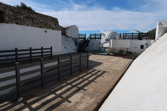 |
| The 100-ton gun has been renovated over the years by British military personnel, the latest being in March 2017 by the officers and soldiers of the 10th Signal Regiment and 11th Signal and West Midlands Brigade. |
Western Beaches
 |
| Looking south at Camp Bay, a rocky stretch of beach on the western side of Gibraltar, adjacent to Camp Bay Road (which becomes Keightley Way Road). The recreation area back from the beach includes two public swimming pools, a ball play enclosure, and anchored concrete pedestal tables (but no chairs). Refreshments can be purchased from The Dolphin Restaurant and Cabana Beach Bar restaurant at Camp Bay. |
 |
| The waves of Gibraltar Bay roll ashore on Camp Bay's rocky beach on a sunny, warm late November day. Camp Bay is the site of Gibraltar's first artificial reef, created in 1974 and comprising barges and other decommissioned vessels sunk offshore to provide a haven for marine life and a site for recreational diving. |
 |
| At 180 metres (590.5 feet) in length and 25,348 gross tonnes, the Malta-flagged liquified petroleum gas (LPG) tanker Searambler dwarfs the 102 metre (334.6 foot), 4,599-gross tonne, Gibraltar-flagged oil products tanker Nisyros in Gibraltar Bay, as seen from the beach at Camp Bay. |
 |
| The Parson's Lodge Battery sits high atop a rocky promontory overlooking Camp Bay's northern end and Rosia Bay's southern end. The site of Parson's Lodge Battery was part of the defensive wall and towers built by the Moors and was later reinforced by Spanish engineers. The British installed guns in the fortifications around 1725 and Parson's Lodge Battery served an important role during the Great Siege of 1779-83, defending British ships unloading supplies in Rosia Bay after running the Franco-Spanish naval blockade of Gibraltar. Parson's Lodge Battery was equipped with heavy guns from 1868, with three 10-inch rifled muzzle-loading guns in protected casemates present by 1873. All of the battery's guns had been removed by 1892 but, in 1898, electric searchlights were installed and these were used throughout the First and Second World Wars. Anti-tank and anti-aircraft guns, as well as anti-aircraft searchlights, were installed at Parson's Lodge Battery in 1941 and used on many occasions against Vichy French and Italian air raids. Parson's Lodge Battery was abandoned by the military in the 1950s and slowly became dilapidated. Since 1993, a charitable trust established by the Gibraltar Government and the Gibraltar Heritage Trust has raised money to restore the Parson's Lodge Battery. |
 |
| Cascading down the rock face looming over Keightley Way Road near Little Bay Beach on the western side of Gibraltar, this man-made waterfall discharges salt water from the Glen Rocky reverse osmosis desalination plant. The city's fresh water supply comes from rainwater and desalinated seawater, with the fresh water stored in 12 reservoirs excavated inside the Rock of Gibraltar. |
 |
| The Keightley Way tunnel, which runs southeast through the Rock between Little Bay on the western side of Gibraltar and the Ibrahim-al-Ibrahim Mosque on the eastern side. Completed in 1960, the Keightley Way tunnel was the last surface tunnel to be excavated in Gibraltar. It is 412 metres (1,351.7 feet) long and today accommodates a single southbound lane for vehicle traffic and a pedestrian lane. The tunnel and its roadway are named after General Sir Charles Keightley, Governor of Gibraltar between May 1958 and October 1962. |
Europa Point
 |
| The Ibrahim-al-Ibrahim Mosque, also known as the King Fahd bin Abdulaziz al-Saud Mosque or the Mosque of the Custodian of the Two Holy Mosques. Located at Europa Point, the mosque faces south towards the Strait of Gibraltar and Morocco, lying only 13 kilometres (8 miles) away. The building was gifted to Gibraltar by Saudi Arabia's King Fahd and took two years to construct, costing around £5 million. It was officially opened on 8 August 1997 and is the southernmost mosque in continental Europe and one of the largest mosques in a non-Muslim country. Gibraltar's approximately 1,000 Muslims (~4% of the total population) use the mosque for worship and the building is open to the public during the day. Inside, the mosque contains classrooms, a conference hall, library, kitchen, morgue, nursery, women's prayer hall, and offices, as well as the Imam's living quarters and a large men's prayer hall featuring nine solid brass chandeliers and walls clad in imported marble. |
 |
| Looking south along Kusuma Promenade running along the eastern side of Europa Point. The Europa Point Lighthouse sits at the southeastern point of the peninsula, overlooking the Strait of Gibraltar. The Kusuma Promenade was officially opened on 29 May 2012, funded in part through a £600,000 donation by the Kusuma Trust Gibraltar in partnership with the Gibraltar Government. It followed the Government of Gibraltar's £4.4 million refurbishment of Europa Point in 2011. |
 |
| Looking north, toward the Rock of Gibraltar and the Ibrihim-al-Ibrihim Mosque. The waters of the Mediterranean lap against the sheer, rocky cliffs of Europa Point. |
 |
| The Europa Point Lighthouse, also known as the Trinity Lighthouse at Europa Point, sits at the southeastern tip of Gibraltar. Built between 1838 and 1841 on the orders of Governor Sir Alexander Woodford, the lighthouse is 20 metres (66 feet) in height and sits 49 metres (161 feet) above the high-water mark. Upgrades to the Europa Point Lighthouse's lamp were made throughout the 1800s and early 1900s, and electric lighting was introduced in 1954-56. In 1994, the lighthouse was fully automated and, since 2016, it has used a Light-Emitting Diode (LED), with its beam visible from 27 kilometres (17 miles) away. |
 |
| The Europa Point Lighthouse is operated by Trinity House, the official authority for lighthouses in England, Wales, and the Channel Islands and is the only Trinity House-operated lighthouse outside of the UK. |
 |
| A mid-19th century magazine built to store ammunition used by the gun batteries along the Europa Point seafront now contains interpretation panels explaining the history, geography, and plant & animal life in and around Europa Point. The magazine structure itself was listed in the first Ordnance Survey map of Gibraltar in 1865 and originally comprised both underground and surface chambers for storing ammunition and powder charges for the nearby gun batteries. The roof of the magazine was removed as part of an earlier development and the current exhibit inside the walls of the structure was inaugurated on 5 June 2018. |
 |
| The Sikorski Memorial, dedicated to General Władysław Sikorski, Commander-in-Chief of the Polish Army and Prime Minister of the Polish government in exile, who died in a plane crash after taking off from Gibraltar's airport on 4 July 1943. This is the third memorial to General Sikorski in Gibraltar, replacing those of 1945 and 2003. The current memorial, unveiled on 4 July 2013, was constructed by Polish company Furmanek Renewal and sits on a circular disc of imported Polish sandstone. A twisted propeller from the B-24 Liberator aircraft in which General Sikorski and 15 other passengers died is mounted on the memorial's plinth, with tablets listing their names and describing the circumstances of the crash. A carved stone Polish military eagle sits atop the peak of the memorial. |
 |
| The northern portion of Morocco's Rif mountain range, including Jebel Musa (Mount Moses), can be seen across the 13 kilometre (8 mile) wide Strait of Gibraltar from Europa Point. Whereas Gibraltar is known in Greek myth as the northern Pillar of Hercules, Jebel Musa is considered the southern pillar. Jebel Musa rises 842 metres (2,762 feet) and, with Gibraltar, marks the entrance to the Mediterranean Sea from the Atlantic Ocean. |
 |
| An abandoned concrete military post on Europa Foreshore looks out over the Strait of Gibraltar, with Jebel Musa and northern Morocco visible in the distance. The Europa Foreshore is scattered with former 20th century military installations, including the Europa Point Defence Electric Lights (searchlights) and the Royal Navy Wireless Station (known as Rock WT), including the pylon platforms and a pillbox defending its approach. |
 |
| Harding's Battery, built in 1859 on the site of a previous battery at Europa Point and named in honour of Sir George Harding, Gibraltar's Chief Engineer. Sir George was involved in the destruction of Spanish fortifications along the border between Spain and Gibraltar on 14 February 1810, when Spain and Britain allied to fight Napoleonic France and agreed to destroy the fortifications to keep them from falling into French hands. After this feat, the southern point of Gibraltar was known as Harding's Point and this battery was equipped with two 18-pounder guns, later replaced by two 32-pounder guns. |
 |
| In 1878, a 12.5-inch, 38-ton Rifled Muzzle-Loading gun capable of firing an 800-pound (362.8 kg) projectile across to the far side of the Strait of Gibraltar was commissioned for this site. The large gun was later removed and, during the Second World War, Harding's Battery hosted a 40mm Bofors anti-aircraft gun. |
 |
| The brick, barrel-roofed former magazine underneath Harding's Battery now contains illuminated display boards presenting information on Gibraltar's history, geography, and wildlife. |
 |
| Buried under a mound of sand sometime after the Second World War, Harding's Battery was excavated and refurbished as part of the development of Europa Point in 2010-11. In 2013, a 12.5-inch, 38-ton Rifled Muzzle-Loading gun dating from the 1870s and identical to that which originally equipped Harding's Battery was found half-buried near the south end of the Gibraltar dry docks. This gun was excavated, transported to Harding's Battery, and installed on a custom-made replica gun carriage atop the battery. |
 |
| Walking along Europa Foreshore. The scrubby vegetation reflects the rocky soil and local weather conditions, which range from long, hot, dry Mediterranean summers to severe winter storms, with salt-laden winds from the east a constant throughout the year. As such, the plants that can survive on Europa Foreshore are tough and resilient and transform from scorched and brown at the end of summer to an explosion of colour in the spring when flowering. Gibraltar Sea Lavender (Limonium emarginatum) is native to the European and African shores of the Strait of Gibraltar and grows nowhere else in the world; it has leathery, slightly succulent leaves well-adapted to life near the sea and can be found growing on the limestone cliffs around Europa Point and rocky areas close to the shore. |
 |
| Looking west across the Strait of Gibraltar from Europa Foreshore, with the southwestern point of the Bay of Gibraltar visible in the distance. Due to its channelling effect on migratory species, the Strait of Gibraltar hosts a diversity of marine life, with orcas feeding on the large Bluefin tuna that make twice-annual migrations in and out of the Mediterranean. Additionally, common and striped dolphins are often found in the Strait and the Bay of Gibraltar, with many being permanent residents and sustaining the Gibraltar dolphin-watching tourism industry. |
 |
| A concrete bunker, once part of Gibraltar's military defences, sits atop a rocky outcrop on Europa Foreshore, overlooking the Strait of Gibraltar. The mountains of Morocco are just visible on the horizon. Europa Point is a prime birdwatching site, with birds of prey, seabirds, and songbirds all migrating between Africa and Europe via the Strait of Gibraltar. |
 |
| The Shrine of Our Lady in Europe, a Roman Catholic parish church at Europa Point. As the national shrine of Gibraltar, it is dedicated to Our Lady of Europe, the Catholic patroness of Gibraltar. This church sits on or near the site of a mosque originally built by the Moors in the early 1300s and converted into a Christian shrine during the first Spanish occupation of Gibraltar (1309-1333). The Moors recaptured Gibraltar in 1333 and converted the shrine back to a mosque; however, following Spain's recapture of Gibraltar in 1462, the mosque was again converted to a shrine and enlarged. Over the next two centuries, ships passing through the Strait of Gibraltar saluted the shrine and sailors came ashore to pray for safe passage and to leave gifts to the shrine. An oil light was kept burning in the shrine's tower 24 hours a day to aid the ships, making the shrine Gibraltar's first lighthouse. When an Anglo-Dutch fleet attacked and captured Gibraltar in August 1704, the shrine served as a refuge for the town's women and girls. British troops looted the shrine and the building was then used by the British military as a storage depot and, later, a garrison library. Heavily damaged during the Great Siege of Gibraltar by Franco-Spanish forces in 1799-83, the shrine was demolished and rebuilt sometime after the siege but remained a Ministry of Defence property until 1961, when it was ceded to the Roman Catholic Diocese of Gibraltar. A mass celebrated on 28 September 1962 was the first held at the shrine in 258 years. The Shrine of Our Lady of Europe was rebuilt in 1997. |
 |
| Looking north at the plateau named Windmill Hill and, towering above it, the Rock of Gibraltar. O'Hara's Battery sits atop the highest point, 426 metres (1,397.6 feet) above sea level. The Rock of Gibraltar is composed of Jurassic limestone formed in a shallow tropical ocean around 200 million years ago and pushed upward over time as the African continent drifts northward. |
 |
| Inside a Gibraltar Bus Company coach serving Route #2, which runs between Europa Point and the Market Place Terminal near Grand Casemates. |
Gibraltar National Museum
 |
| The Gibraltar National Museum, located on Bomb House Lane near Line Wall Road in the historic Gibraltar city centre. Founded in 1930 by then-Governor Sir Alexander Godley, the museum is housed in two former military quarters, including Ordnance House, the former residence of the British Army's Assistant Director of Ordnance Stores in the colony. The museum features exhibits devoted to Gibraltar's history, culture, and flora & fauna, but its centrepiece is the 14th-century Moorish bathhouse excavated in the Ordnance House's basement. |
 |
| A ticket for the Gibraltar National Museum, depicting Nana, the name given to one of the Neanderthal skeletons discovered on Gibraltar and used to create this forensic recreation of what she may have looked like when alive tens of thousands of years ago. Admission to the museum is £5 (adult). |
 |
| A large, glass-enclosed tabletop model of Gibraltar completed in 1865 from surveys conducted by Lieutenant Charles Warren, Royal Engineers, under the direction of Major General Frome, Royal Engineers. The model was carefully painted by Captain B.A. Branfill of the 86th Regiment in 1868. The model's scale is 1/600, or 50 feet to one inch, and it includes accurate depictions of all buildings in the colony at the time of the survey. |
 |
| Inside the Moorish bath house in the museum's basement, dating from the Marinid Sultanate (1244-1465) and considered one of the best-preserved Moorish bath houses (or Hammams) in Europe. They are similar to bath houses at Fez in Morocco, Tlemcen in Algeria, and Valencia in Spain. The narrow passage links the sequence of chambers comprising the bath house. Built as private baths within the palace of the Moorish Governor of Gibraltar, these chambers were used as stables while the building was under the control of the British military after 1704. The bath house is smaller than it originally was due to damage suffered during the Great Siege of Gibraltar in 1779-83. The bath house chambers are similar to the Roman Hypocaust system, which included a room at normal temperature for undressing, a cold room, and a hot room. Underfloor ducts carried hot air to heat the bath house. Much like a modern sauna, moving between the hot and cold temperatures in the chambers would cleanse the skin through sweating. |
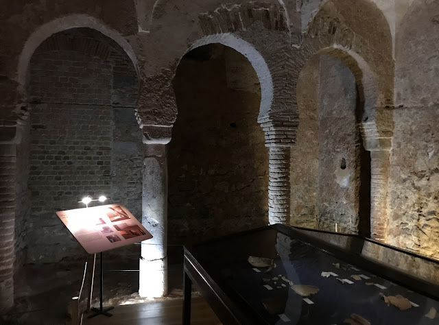 |
| The Tepidarium (Bayt al wastani, or Central Room) was the bath house complex's main and largest room and features a domed ceiling and six stone arches supported on columns. The walls would have originally been plastered and decoratively painted, with some remnants of red and black paint still visible on the sections of wall supporting the dome. The areas behind each set of arches would have been partitioned off with curtains to form individual cubicles where bathers would have undressed and to which they would have returned to relax following their ablutions. The underfloor ducts carrying hot air from the nearby boiler to heat the floor of the room can be seen. It is believed that bathers would have periodically poured buckets of cold water on the heated floor of the Tepidarium to create steam, evidenced by the visible run-off channels at the room's southern end. |
 |
| A closer look at one of the intricately-carved stone capitals atop a column in the Tepidarium. The six arches in the Tepidarium are supported on differing columns and capitals, with three of the columns in the centre being being made of polished stone while one column, added much later, is built of brick. Two of the four capitals on the columns on the north side of the chamber are Visigothic in origin, with one being Roman. |
 |
| The Caldarium (Bayt assajum or 'Hot Room') was the hottest of the bath house chambers, with a hypocaust system heating the floor from underneath. Some of the original flooring and drainage canals have survived at the northern end of the chamber. The adjacent boiler room would have held supplies of wood for the boiler and furnace used to generate the heat for the Caldarium, tended by household staff in the 14th century. |
 |
| Star-shaped openings in the barrel-vaulted ceiling over the changing cubicles in the Tepidarium were designed to let in natural light for the bathers. |
Cruise Ships in Gibraltar
 |
| The MS Queen Victoria, a Vista-class cruise ship of the Cunard Line, moored at the cruise ship pier on Gibraltar Harbour's North Mole on 21 November 2022. Queen Victoria was built at the Fincantieri Marghera shipyard in Italy and entered service in December 2007. She is 90,049 gross tonnes and measures 294 metres (964.5 feet) in length, with a beam of 32.3 metres (106 feet). Carrying a crew of 900, Queen Victoria has a capacity of 2,081 passengers and features seven restaurants, 13 bars, three swimming pools, a ballroom, and a theatre. |
 |
| With the mountains of Morocco visible across the Strait of Gibraltar, MSC Musica enters the Bay of Gibraltar on 19 November 2022 to berth at the city's cruise ship pier. Built by Chantiers de l'Atlantique of France, MSC Musica entered service in 2006 for Geneva-based MSC Cruises. She displaces 92,409 gross tonnes and measures 293.83 metres (964 feet) in length, with a beam of 32.31 metres (106 feet). MSC Musica carries a crew of 987, with a capacity for 2,550 passengers. |
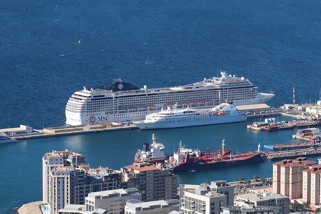 |
| MSC Musica berthed at the cruise ship pier at Gibraltar's North Mole on 19 November 2022, as seen from the top of the Rock of Gibraltar. Berthed at the inner pier is the Star Legend, a small (12,995 gross tonne) luxury cruise ship built by Schichau-Seebeckwerft in Bremerhaven, Germany in 1992 and operated by Miami-based Windstar Cruises. Star Legend carries a crew of 164 and 312 passengers. |
 |
| Steaming toward Gibraltar on 20 November 2022 is Costa Fascinosa, a Concordia-class cruise ship operated by Genoa-based Costa Cruises. Built by Fincantieri's Marghera shipyard in Venice, the Costa Fascinosa entered service in 2012. She weighs 114,500 gross tonnes and measures 290.2 metres (952 feet) in length, with a beam of 35.4 metres (116 feet). |
 |
| Costa Fascinosa in the Bay of Gibraltar, approaching the North Mole's cruise ship pier with the Spanish city of Algeciras in the background. The ship carries a crew of 1,100 and 3,780 passengers. |
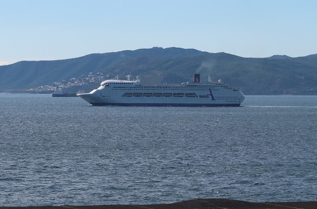 |
| MS Ambiance departs Gibraltar on 20 November 2022. Built by Italy's Fincantieri shipyard for Princess Cruises in 1991 and originally named Regal Princess, Ambiance is now owned by England-based Ambassador Cruise Line. Under the name Satoshi in 2020-2022, the ship was intended to become a floating residence in the Gulf of Panama; however, when insurance could not be obtained, she was sold to Ambassador Cruise Line and commenced service under her current name in April 2022. The Bahamas-flagged Ambiance is 70,285 gross tonnes and measures 245.06 metres (804 feet) in length. She carries a crew of 660 and 1,400 passengers. |
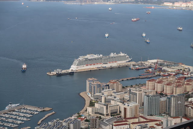 |
| A view of Regal Princess docked at the Gibraltar cruise ship pier, as seen from the top of the Rock of Gibraltar on 22 November 2022. One of six Royal-class cruise ships operated by Princess Cruises, Regal Princess was built at Fincantieri's yard in Monfalcone, Italy and entered service in May 2014. The 142,714-gross tonne vessel was christened in November 2014 by the cast of 1970s television show The Love Boat, including Gavin MacLeod, Bernie Kopell, Fred Grandy, Ted Lange, Lauren Tewes, and Jill Whelan. Regal Princess has 19 decks and measures 330 metres (1,082 feet 8 inches) in length, with a beam of 38.4 metres (126 feet). She carries a crew of 1,346 and 3,560 passengers. |
 |
| Cunard Line's Queen Victoria departs for Lisbon, Portugal after a seven-hour port call in Gibraltar on 21 November 2022. |
Gibraltar Botanic Gardens (The Alameda)
 |
| The George Don Gates marking the entrance to the Gibraltar Botanic Gardens, also known as the Alameda, located off Red Sands Road to the south of the historic city centre. The Red Sands area south of the city walls was long used as a burial ground and for military exercises. The gardens were laid out at the direction of Gibraltar's Governor, General Sir George Don, in 1816 as a recreational area for British soldiers stationed in the colony and Gibraltar's civilian population. After the gardens fell into disrepair from the 1970s onward, a refurbishment and restoration effort was carried out in 1991 and in 1994 a zoo was added, the Alameda Wildlife Conservation Park. |
 |
| The broad stone steps leading up to the gardens. |
 |
| Flanking the stone steps are two of the four muzzle-loading Russian 24-pounder guns captured by British forces during the Crimean War in 1854-1856 and gifted to Gibraltar in 1858. (The other two guns are displayed at War Memorial Steps on Line Wall Road.) Markings on the guns indicate they were manufactured in 1826 and 1827, during the reign of Tsar Nicholas I, in the Alexandrovski factory. The Imperial Russian crest is on the tompion in each gun's muzzle. |
 |
| A colourful Moroccan-style tiled fountain inside the forecourt of the botanic gardens. The fountain was inaugurated by Their Royal Highnesses Prince Edward and Princess Sophie, Earl and Countess of Wessex, on 12 June 2012. The dedication plaque reads, 'This fountain was created in recognition of the people of Morocco who crossed the Strait in order to help the people of Gibraltar in a time of need. It is a symbol of friendship between the two people in the past, the present, and the future'. |
 |
| A ceramic tile map of the Gibraltar Botanic Gardens near the entrance. The gardens cover 15 acres. |
 |
| A second set of iron gates at the top of the steps. These gates are adorned with the crest of the Royal Engineers. |
 |
| Looking north, down the steps of the Alameda's entrance. The landing midway up the steps is covered by a pebble mosaic of the Royal Cypher of the late Queen Elizabeth II in honour of her one and only visit to Gibraltar on 10 May 1954. Arriving on the Royal Yacht Britannia, the 27-year old Queen was accompanied by her husband, Prince Philip, and children Prince Charles and Princess Anne. The two-day visit involved a program of ten ceremonies in the span of 13 hours, including a review of 3,000 British Army, Royal Navy, and Royal Air Force personnel and a 21-gun salute. The Queen also visited the Alameda and planted a tree. |
 |
| The General George Augustus Eliott Memorial sits at the top of the Queen Elizabeth II stairs at the garden entrance. A memorial to General Eliott, Governor of Gibraltar between 1777 and 1790, was originally commissioned by Governor Don in 1815 but took the form of a massive wooden statue of Eliott carved from the bowsprit of a Spanish ship captured during the Battle of Trafalgar (21 October 1805). This statue was installed in the Governor's residence, the Convent, and in 1858 a bronze bust of Eliott was presented to Gibraltar by Eliott's descendant, Sir Trayton F Eliott Drake Bart, and installed in the Alameda. The bust was installed atop this stone column, erected under the auspices of then-Governor Lieutenant General Sir James Fergusson. The Eliott Memorial is flanked by four 18th-century bronze howitzers. |
 |
| The bust of Sir George Augustus Eliott towers over the gardens, including this bed of various cacti and succulents. |
 |
| The entrance to the Guiseppe Codali Bridge, which crosses the Dell, an Italian-style sunken garden filled with lush Mediterranean plants. |
 |
| The Giuseppe Codali Bridge crossing the Dell is covered by a canopy of purple bougainvillea. |
 |
| The eastern side of the Dell, an Italian-style sunken garden planted in a natural hollow, that is the centrepiece of the botanic gardens and the brainchild of head gardener Giuseppe Codali in the 1870s. The Italian influence of the Dell is shown in its collection of sub-tropical plants and use of terracing. A small wrought iron fountain between the two staircases provides the relaxing sound of running water in this quiet, secluded space. The lawn features a red brick depiction of Gibraltar's coat of arms, a triple turreted castle, with a large key underneath. |
 |
| The western side of the Dell is ringed with big, sub-tropical trees and shrubs and features a grassy lawn and a small koi pond. |
 |
| A bronze bust of Giuseppe Codali (1847-1917), garden designer, horticulturist, and head gardener of the Alameda. The bust was commissioned by Codali's great, great grandchildren and presented to the botanic gardens in December 2014. Giuseppe Codali was born in Bergamo, Italy and arrived in Gibraltar in the 1870s with a commission to beautify and transform the Alameda into a landscape garden and recreational area. He was also responsible for designing several other gardens in Gibraltar and Spain. Codali's most famous legacy at the Alameda was the Dell, the centrepiece of the gardens. |
 |
| The shady, tranquil Lion's Pond in the grounds of the Gibraltar Botanic Gardens was inaugurated on 31 May 1986. |
 |
| Exotic cacti and succulents in a series of terraced beds near the Eliott Memorial. |
 |
| Sculptures and plants in one of the garden beds. In the distance is a 2001 sculpture of the character Molly Bloom from Irish poet and writer James Joyce's 1922 novel, Ulysses. |
 |
| A bed of cacti and other drought-resistant plants native to the Sonoran Desert covering parts of west and northwest Mexico and the southwest United States, especially Arizona. |
 |
| A Mediterranean fan palm (chamaerops humilis), found growing wild around Gibraltar, including in poor, rocky soil atop the Rock of Gibraltar. The slow-growing Mediterranean fan palm is one of the most cold-hardy palms and grows as a shrub-like clumping palm. Although tolerating temperatures as low as -12 Celsius (10 Fahrenheit), it prefers hot summers. |
 |
| A wooden walkway leads through the African plants beds, filled with lush tropical species. |
 |
| The walkway meanders through the Alameda's large and diverse collection of African plants. |
 |
| Stone beds contain various species of palm and other sub-tropical plants along one of the arterial walking paths through the gardens. |
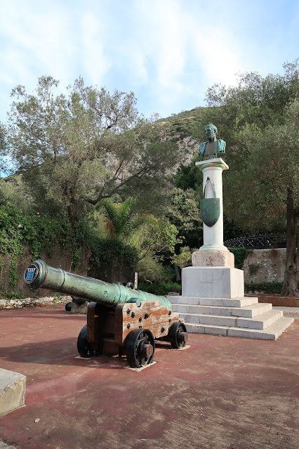 |
| A bronze bust of Arthur Wellesley, 1st Duke of Wellington (1769-1852), victor of the Battle of Waterloo in 1815 and later a two-time Prime Minister of the United Kingdom. The marble pillar on which the bust sits was brought from Roman ruins in Libya and the memorial was erected here in 1819. The column is flanked by two 13-inch mortars and a bronze 12-pounder gun dating from 1758. The memorial was funded by deducting a day's pay from all members of the British garrison of Gibraltar and the bronze bust of Wellington was cast from guns seized by Wellington during his campaigns in the war against Napoleonic France. |
 |
| A colourful flower head on a clivia miniata. |
 |
| A pedestrian walkway through the Gibraltar Botanic Gardens, as seen on 20 November 2022. The 15-acre gardens contain a wide range of both native and foreign plant species from Mediterranean climatic zones, including hibiscus, cacti, bougainvillea, stone pine, wild olive, various species of palm, jasmine, geraniums, dragon tree, Gibraltar candytuft, and Chinese wisteria. Some of the trees from the gardens' earliest days (stone pine, wild olive, dragon tree) pre-date the establishment of the gardens and are thus over 200-years old. |
 |
| The glass Bicentenary House, opened on 14 April 2016 to commemorate the 200th anniversary of the Alameda. |
Gibraltar Cable Car
 |
| The Gibraltar Cable Car base station on Red Sands Road, to the south of the historic city centre and adjacent to the Alameda Gardens. The cable car is the easiest and fastest way to get to the top of the Rock of Gibraltar and the many attractions and historic sites in the Gibraltar Nature Reserve. The Gibraltar Cable Car was built in 1966 by Swiss company Von Roll Holding AG and takes riders up 412 metres (1,352 feet) at a speed of 18 km/h (11.2 mph). |
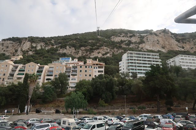 |
| Looking up towards the top of the Rock from inside one of the two cable cars that run on the aerial tramway. |
 |
| A view from outside the cable car base station, with one car ascending and the other descending on the opposite cable. The trip to the top station takes approximately six minutes, though guests can also disembark at a station at the midway point closest to the Apes Den where many of the famous Barbary macaques living on the Rock reside. |
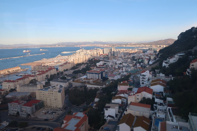 |
| The view looking north from the Gibraltar Cable Car as it ascends the Rock of Gibraltar. |
 |
| Each cable car can hold a maximum of 30 passengers and an operator. The first cable car each day departs the base station at 9:30am and crowds are lightest at this time, especially as the hordes of cruise ship passengers have not yet made it into town. |
 |
| Looking down at Gibraltar Harbour as a cable car approaches the top station, passing over Signal Station Road below. |
 |
| A cable car passes one of the cable support towers, this one next to Charles V Road, running north-south midway between the summit station and the middle station. During the last major refurbishment of the Gibraltar Cable Car system in 1986, the original cable cars were replaced with the ones currently in use. |
 |
| Approaching the final destination: the top station. |
 |
| The loading pier at the top station, with an empty car ready to take passengers back down at the end of their visit to the Gibraltar Nature Reserve atop the Rock. |
 |
| The cable car's top station features expansive views in all directions from various observation terraces. The station also contains the Top of the Rock Café, the Mons Calpe Suite Restaurant, toilet facilities, and a souvenir shop. The last cable car down to the base station departs the top station at 7:45pm daily. |
 |
| The cable car's top station sits on the site of the former Signal Hill Battery, which was originally equipped with two 3-inch anti-aircraft guns and one 40mm Bofors gun during the Second World War. Built in 1966 along with the rest of the cable car system, the top station was renovated in 2007. Flying stiffly in the strong, windy conditions atop the Rock is the distinctive Gibraltar flag, with its red castle and gold key symbolising the fortress of Gibraltar (as the peninsula was known) and its significance to the Moors and Spanish as the key to Spain and to the British as the key to the Mediterranean. |
 |
| Looking northwest from one of the terraces at the top station, with the city and harbour of Gibraltar below and the Bay of Gibraltar and Spanish coastal towns that ring it visible in the distance. |
 |
| The main observation terrace at the top station, with stunning views of the Rock of Gibraltar's distinctive limestone peaks, the Bay of Gibraltar to the west, Spain to the north, and the Mediterranean Sea to the east. Sitting at the very summit of the peak in the distance is the Royal Air Force radar site at Rock Gun Battery, which provides air traffic surveillance for Gibraltar Airport, which is used by both civilian and military aircraft. Cool morning temperatures and strong winds at this altitude may necessitate a coat, even on an otherwise pleasantly warm day at ground level. |
 |
| The wreck of MV OS 35, a Japanese-built, Tuvalu-flagged bulk carrier that sank off Gibraltar's east coast on 29 August 2022. The 20,947-gross tonne, 178 metre (584 foot) ship, carrying 33,632 tons of steel bar, struck the liquid natural gas carrier Adam LNG when departing Gibraltar Harbour and was beached in shallow water. A gash that subsequently opened on OS 35's starboard side caused the loss of structural integrity and the ship settled on the seabed, partially submerged. At the time of this photo, the wreck was surrounded by a boom to contain leaking fuel from OS 35's tanks and efforts were underway to remove the steel bar cargo from the holds. |
 |
| Looking down the vertical drop from the signal station to the east coast of the Gibraltar peninsula; seagulls can be seen wheeling below on the air currents. The beachfront village of Sandy Bay, with its whitewashed homes and rocky groynes reaching out into the Mediterranean to protect the beach, can be seen far below. The dusty brown terrain in the centre of the photo is the Great Gibraltar Sand Dune, on which used to exist a 34 acre (140,000 square metre) water catchment system consisting of corrugated steel sheets that fed rainwater into an open channel emptying into the reservoir system excavated inside the Rock. The water catchment system was built and expanded between 1903 and 1961, but was dismantled between 2001 and 2006 when Gibraltar moved to desalination of seawater as its source of fresh water. The Great Gibraltar Sand Dune has now been restored to its natural state, with native vegetation established. |
 |
| The ruins of the Signal Hill Battery's signal station, sitting at 370 metres (1,200 feet) above sea level. The British established a signal station here in 1727 but it was abandoned in 1922 because Levant cloud often obscured the view and impeded visual signalling. (Levant cloud is formed over the Rock of Gibraltar when moist easterly winds hit the eastern side of the Rock, rise, and condense into cloud.) The signal station's duties were transferred to the Windmill Hill Signal Station near the southern end of the peninsula. |
Gibraltar Nature Reserve
 |
| Walking south along St Michael Road toward the Barbary macaque feeding station (on the left). |
 |
| Looking north, with the Barbary macaque feeding station on the right and the old signal station above. The feeding station was once the site of the El Hacho fort and, later, a signal station at the upper terminus of the 16th century Charles V Wall. |
 |
| A Barbary macaque clings to the precipitous cliffs on the eastern side of the Rock, studded with Mediterranean fan palms and scrubby vegetation. The spherical white domes of the Royal Air Force radar station at Rock Gun Battery to the north can be seen in the distance. |
 |
| Two Barbary macaques visit the feeding station on St Michael Road to partake in some of the delicacies provided by their keepers: citrus wedges, watermelon slices, carrots, and sweet potatoes. This species of macaque is native to the Atlas Mountains of Algeria, Libya, Tunisia and Morocco, and the small population in Gibraltar is believed to have been introduced by the Moors in the Middle Ages. The average lifespan of a male Barbary macaque is 25 years, while females may live up to 30 years. Gibraltar's population of around 300 Barbary macaques is the only one outside North Africa and the only population of wild monkeys in Europe. While Gibraltar's Barbary macaque population is stable or increasing, populations in North Africa are in decline due to habitat degradation, poaching, and retaliation for raiding farmers' crops. As such, the Barbary macaque has been labelled as endangered by the International Union for the Conservation of Nature. Given the legend that Gibraltar will remain British as long as there are Barbary macaques living on the Rock, when British Prime Minister Winston Churchill was informed about the macaques' declining population during the Second World War, he ordered more of the macaques imported to Gibraltar to reverse the decline. |
 |
| A warning sign at the top of the stairs of the Charles V Wall, near the Barbary macaque feeding station. |
 |
| Continuing south along St Michael Road, running along the spine of the Rock of Gibraltar toward the SkyWalk attraction. |
Skywalk
 |
| The Skywalk, a glass-floored observation deck sitting 340 metres above sea level, provides stunning views in all directions, as well as a precipitous look straight down the sheer east side of the Rock. Officially inaugurated by American actor Mark Hamill (Luke Skywalker in Star Wars) on 21 March 2018, the Skywalk was built on the foundations of a Second World War structure. It is secured to the Rock using 70 metres (229.7 feet) of rock anchors and 30,000 kilograms (66,138 pounds) of steel. |
 |
| Barbary macaques are regular visitors to the Skywalk, lounging on the glass floor suspended over the cliff face or walking easily along the handrails. The Skywalk is designed to withstand wind speeds of over 150 km/h (93 mph) and bear the weight of 340 people, the equivalent of five Asian elephants. Nevertheless, for safety reasons, a maximum of 50 visitors are permitted on the floor at any one time. |
 |
| A group of Barbary macaques lounge around the Skywalk on the morning of 19 November 2022. The macaques live in hierarchical social groups, in which individuals have different dominance ranks. In general, macaques that have similar ranks and/or are directly related to each other spend more time in close proximity and offer mutual support in conflicts with other macaques. The macaques spend much time grooming each other, which is both a reflection of their social bonds and a means of strengthening those bonds. |
 |
| From the Skywalk, visitors can see the Spanish coast leading away to the west and northeast, as well as the coast of Morocco to the south. The floor and vertical panels are made from up to four layers of laminated glass, totalling approximately 4.2 centimetres (1.65 inches). The glass floor is 2.5 metres (8.2 feet) wide and projects a maximum of 6.7 metres (21.98 feet) from the Skywalk's main structural support point. |
 |
| The Barbary macaques of Gibraltar climb effortlessly and acrobatically on the railings and glass panels of the Skywalk. Although the macaques are habituated to humans because of the regular flow of tourists, they will react aggressively if provoked by attempts to physically touch them or invade their personal space. The macaques will signal their displeasure and intent to lunge or bite by making eye contact and showing a pouted mouth beforehand, though this will not generally be accompanied by any noises. Visitors are advised to keep their distance from the macaques, not attempt to touch them, and pay attention to behavioural signals. |
 |
| Looking north at the Skywalk while proceeding south along the Douglas Path. |
Douglas Path
 |
| The Douglas Path runs parallel to the paved St Michael Road but elevated along a sharp ridgeline that provides fantastic all-round views. The path, named after Captain William Douglas of the 11th Regiment of Foot, was cut by convict labour to ease the passage of troops on the Upper Rock. The path commences with a steep set of stone and gravel steps. |
 |
| Looking down over the cliff at the Sandy Bay community on Gibraltar's east coast. |
 |
| A vertigo-inducing view of Gibraltar from the Douglas Path, high atop the Rock. Gibraltar city and the Bay of Gibraltar can be seen on the left (west), while the Mediterranean can be seen on the right (east). |
 |
| The Douglas Path was designed to connect a series of military installations, and here stands a circular stone advance look-out post at the top of the stone steps. Once thought to date from the Moorish period, this post was likely built by the British Army sometime after the capture of Gibraltar in 1704 but is believed to have been constructed using stone from an earlier building. As such, it is one of the oldest surviving structures atop the Rock of Gibraltar. The look-out post was manned up to the mid-19th century, at which point the heavy militarisation of the Upper Rock and the erection of fencing would have rendered it obsolete. |
 |
| The Douglas Path leads into a complex of stone, brick, and concrete structures dating from the Second World War. These buildings comprised a command post for the commander of the Fortress of Gibraltar. |
 |
| The abandoned command post contains several buildings, their windows protected only by metal bars. |
 |
| Inside one of the buildings of the former Second World War command post. |
 |
| A breezeway between buildings of the command post, following the Douglas Path to the south. |
 |
| Looking north along the ridgeline. On the nearest peak sits the remnants of the abandoned military signal station (including a modern day cellular tower) while on the peak in the distance sits the modern Royal Air Force radar installation. The Great Gibraltar Sand Dune on the eastern side of the Rock slopes down to the Mediterranean. |
 |
| While most of the Upper Rock is now open to visitors, certain areas remain the property of the Ministry of Defence, including Spy Glass Battery, the entrance of which is seen here. Constructed in 1898, Spy Glass Battery was originally the site of six Rifled, Muzzle-Loading (RML) 10-inch guns, each weighing 18 tons. These high-angle guns were installed in a sunken position which allowed the guns to fire upwards, with the shells intended to plunge downward into the thinner deck armour of enemy warships rather than their thicker side armour. The sunken gun positions at Spy Glass Battery also provided the gun crews with added protection as the guns were hidden from view. During the Second World War, Spy Glass Battery was equipped with a Bofors anti-aircraft gun and special acoustic listening equipment used to provide early detection of incoming aircraft prior to the widespread deployment of radar. Today, Spy Glass Battery remains under the control of British Forces Gibraltar and is off limits to visitors. |
 |
| Looking west over Gibraltar Harbour and the Bay of Gibraltar from O'Hara's Road, high atop the Rock. With its three large graving docks built in the 19th century, Gibraltar served as a strategic naval base at the gateway to the Mediterranean. In the early 1900s, the danger of a war in the Mediterranean led to a decision to extend the graving docks so that they could accommodate the Royal Navy's large, new battleships and, eventually, aircraft carriers. While the Royal Navy used the Gibraltar dockyard extensively in both World Wars and the post-war period, the UK Government's decision in the early 1980s to reduce the size of the surface fleet rendered Gibraltar dockyard redundant and, in 1982, it was transferred to commercial control. Although the dockyard is now a commercial enterprise run by Gibdock, there is still a naval presence with the Royal Navy's small Gibraltar Squadron and many British and Allied naval vessels still stop in Gibraltar while passing through the Mediterranean or eastern Atlantic. |
Windsor Suspension Bridge
 |
| The Windsor Suspension Bridge measures 75 metres (246 feet) in length, equivalent to 7.5 double decker London buses, and spans a gorge 50 metres (164 feet) deep on the western side of the Rock. It was officially opened on 21 June 2016 along the Royal Anglian Way, a hiking trail in the Gibraltar Nature Reserve named after the 2nd Battalion of the Royal Anglian Regiment which refurbished the trail in August 1969. |
 |
| The bridge was designed and built by local Gibraltar company Bovis Koala, in partnership with Spanish company Muntanya, which has previously been involved in a number of similar projects in the Pyrenees mountain range separating Spain from France. The main structure of the bridge was assembled in Spain and transported to Gibraltar for installation here. |
 |
| A view of the Windsor Suspension Bridge from the footpath that follows the natural curve of the gorge. As a pedestrian suspension bridge, strong winds and the movement of people does cause the bridge to sway slightly, adding to the excitement of crossing this novel addition to the Rock's attractions. |
 |
| The Windsor Suspension Bridge is secured by huge supporting anchors driven 12 metres into the rockface, as well as 8-metre micro-piles fixed to the respective foundation blocks. Two main steel cables running in parabolic curves provide strength to the bridge, with each cable measuring over 80 metres (262.5 feet) in length and 50mm (1.97 inches) in diameter. The bridge deck is supported by 132 steel secondary cables measuring 10mm (0.39 inches) in diameter which are connected to the main structural cables. |
 |
| Looking south at the Windsor Suspension Bridge. Hayne's Cave Battery, built in 1903, sits at the southern end of the bridge, complete with the gun shield and barrel of a 4-inch Quick Firing coastal defence gun which used to occupy the battery until 1940-41. |
Charles V Wall
 |
| The upper portion of the Charles V Wall, a defensive curtain wall built by the Spanish between 1552 and 1599 following a September 1540 attack by Turkish pirates who looted and sacked the town, taking prisoner over 70 residents intended to be sold into slavery. With most of the town's defences facing northwards, the wall was intended to defend the vulnerable southern approaches from further attacks by pirates. Originally known as the Muralla de San Benito (St Benedict's Wall), the wall was renamed in honour of Charles V, Emperor of the Holy Roman Empire, as well as King of Spain, Archduke of Austria, and Duke of Burgundy in the first half of the 1500s. The wall runs east-west from South Bastion in the fortified old city (once the shoreline of the bay) up the western slope to the crest of the Rock. While the lower portion of the wall was completed by 1557, the upper portion was completed in 1599 further to the south, a decision made by Charles V's son and successor, Phillip II of Spain, who believed the defensive wall should be further away from the expanding town. The wall was built by Italian military engineer Giovanni Battista Calvi on the orders of Charles V and, upon his accession to the throne in 1558, Phillip II commissioned the Genoese engineer Giovan Fratino to improve the wall. |
 |
| A gate cut through the Charles V wall on Queen's Road, about midway up the western side of the Rock. |
 |
| Visitors to the Rock may climb the upper portion of the Charles V Wall, restored in 2008, from the Queen's Gate at the lower end to St Michael's Road at the wall's upper terminus. |
 |
| Looking up the narrow stone steps of the upper Charles V Wall, dating from 1599. The zigzag layout of the four segments comprising the upper portion of the wall was designed to provide defenders the ability to give flanking fire to each segment. |
 |
| Looking down the steps of the Charles V Wall during the steep climb up. This is the first of the four segments of the zigzag upper wall. |
 |
| A view to the southwest from the top of the second segment of the zigzag upper Charles V Wall, as seen from Charles V Road. |
 |
| A dizzying view from the top of the fourth and final segment of the zigzag wall. |
 |
| A final view of the upper Charles V wall from its upper terminus at St Michael Road, next to the Barbary macaque feeding station. |
St Michael's Cave
 |
| Entering St Michael's Cave. The cave, located near the southern end of the Upper Rock, was formed over millennia as rain water percolated through points of weakness in the porous limestone and, over time, carved out large caverns and spectacular rock formations. It consists of an Upper Hall, connected by five passages, with drops of various heights to a smaller hall, beyond which a series of narrow holes leads to a further complex of chambers reaching a depth of 62.5 metres (205 feet) below the cave's entrance. The cave was known to the Romans and was long believed to be bottomless. This may have contributed to the legend that Gibraltar was linked to Africa by a subterranean passage running over 24 kilometres (15 miles) under the Strait of Gibraltar, and that the Barbary macaques on the Rock had migrated through this undersea passage. The earliest Roman geographer, Pomponius Mela (AD 15-45), wrote about St Michael's Cave and it has been the subject of many legends and stories over the years. One story claims that, in a 1704 attempt to recapture Gibraltar from the British, a raiding party of 500 Spanish troops spent the night in St Michael's Cave after climbing the steep eastern face of the Rock but were ambushed the next morning by soldiers of the British garrison. Another legend has it that a Colonel Mitchell and another army officer descended into the depths of St Michael's Cave sometime before 1840 and were never seen again, despite attempts by others to explore the cave in 1840, 1857, and 1865. A complete and detailed search of the cave in 1936-38 did not locate any human bones or recent rockfalls that could have covered human remains and the disappearance story could have been entirely concocted. During the Second World War, St Michael's Cave was prepared as an emergency hospital but its use was never required. |
 |
| An immersive light and sound show is projected onto the cave walls and the stalactites and stalagmites every 20 minutes. The show, called 'The Awakening', interprets the powerful geological forces that forged the cave over millions of years, with the stalactites and stalagmites portrayed as long-dormant ancient clocks reawakened to reveal their stories. Stalactites are rock formations that hang from the ceilings of caves and which are created over time through the gradual deposition of calcium carbonate and other minerals dissolved in water. The fastest growing stalactites, fed by a constant supply of slow dripping water rich in calcium carbonate and carbon dioxide grow at a rate of 3mm per year, though the average growth rate of a stalactite is 0.13mm a year. Stalagmites are rock formations that rise from the cave floor as a result of the accumulation of calcium carbonate and other minerals deposited from water dripping through the cave's ceiling. |
 |
| St Michael's Cave is named after an Italian grotto in Monte Gargano which it closely resembles and in which it was said the Archangel Michael had appeared. Although Gibraltar can endure hot Mediterranean conditions in the summer, St Michael's Cave maintains a constant year-round temperature of 16-17 degrees Celsius (60.8-62.6 degrees Fahrenheit). |
 |
| Visitors marvel at the curtain of thin, wavy sheets of hanging calcite known as the Angel of St Michael's Cave because of its resemblance to an angel with outstretched wings. Such curtains are formed when water droplets travel along the cave ceiling before dropping to the cave floor. The Ancient Greeks believed that St Michael's Cave was an entrance to Hades, their mythological underworld, or a shrine to Hercules. |
 |
| Visitors wander along the path snaking around the towering rock formations during the sound and light show. |
 |
| The towering Angel of St Michael's Cave rock formation illuminated during 'The Awakening' sound and light show. |
 |
| Looking up at immense, towering stalagmites thrusting up from the cave floor and the menacingly jagged stalactites hanging from the cave ceiling, all illuminated with dynamic hues of blue, red, purple, and pink. |
 |
| The largest cavern within St Michael's Cave is known as Cathedral Cave. Here it is shown during the culmination of 'The Awakening' sound and light show that is projected onto the walls and ceiling of the cave every 20 minutes. |
 |
| The superb natural acoustics of Cathedral Cave has allowed its use as an auditorium with seating for 400 people since the early 1960s. In addition to hosting the culmination of the 'The Awakening' sound and light show, Cathedral Cave has also been used to stage beauty pageants, comedy acts, ballet, drama, and performances by philharmonic and military orchestras and even rock bands. |
 |
| Visitors take their seats to enjoy a showing of 'The Awakening', the light show spectacle depicting the formation of St Michael's Cave, accompanied by haunting music representing fire, water, and immense tectonic fores. |
 |
| Patterns of blue and green light splash across the rock walls and ceiling, representing the powerful role of water in forming and shaping St Michael's Cave. |
 |
| 'The Awakening' concludes and the regular lighting returns to the cave until the next showing in 20 minutes. |
 |
| A final look at St Michael's Cave: a view from the top of the auditorium seating in Cathedral Cave, showing the enormity of this subterranean cavern. A giant columnar calcium carbonate formation, known as a stalacto, stands in the middle of the bank of seating. A stalacto is formed when a stalactite hanging from the cave roof joins a stalagmite growing up from the cave floor. |
 |
| Located at the junction of Queen's Road and Spur Battery Road on the Upper Rock is the Queen's Balcony. At this spot, marked by a stone plaque, Her Majesty Queen Elizabeth II and His Royal Highness The Duke of Edinburgh took in the spectacular view of Gibraltar during their one and only visit on 10-11 May 1954. |
 |
| Piles of heavy iron chain fastened to iron hooks anchored in the limestone can be found at various locations on the Rock. Until the 20th century, gunners hauled heavy artillery pieces from sea level up to the top of the Rock using ropes and chains passed through the iron rings. These rings were installed along all roads leading to the Upper Rock. |
 |
| A closer look at one of the heavy iron rings installed throughout the Rock to aid in moving artillery pieces to and from the Upper Rock's coastal defence batteries. In the days before motorised transport, heavy guns had to be moved through brute manual labour by the gunners. |
 |
| A remnant of one of the fence lines that once protected different areas of military significance on the Upper Rock. While most of these spiked, iron fences have been torn down, portions survive on the Upper Rock and in the southwest area of Gibraltar. This so-called 'Unclimbable Fence' was developed at the direction of the British War Office in 1907 in order to reduce the need for sentries while protecting military facilities. On the Upper Rock, such fencing kept goat-herders and their animals off of military property, with the consequence that woody vegetation was allowed to grow on the slopes above the fence line in the absence of grazing animals. |
Princess Caroline's Battery and the Military Heritage Centre
 |
| Princess Caroline's Battery is located at the northern end of the Upper Rock and looks over the North Front area of Gibraltar, including the airport and the Spanish frontier. This strategically-important position was originally known as Salto de Lobo (Wolf's Leap) and was one of a number of gun emplacements collectively known by 1730 as Willis's Batteries. In 1732, these batteries were each named after members of the Royal Family, with this battery named after Princess Caroline (1713-57), the daughter of King George II. The battery was damaged by Franco-Spanish forces during the Great Siege of Gibraltar in 1779-83 and repaired. In 1871, Princess Caroline's Battery was equipped with a 9-inch Rifled Muzzle-Loading (RML) gun and this was replaced in 1905 by a single 6-inch Mark VII breech-loading gun installed above a new underground magazine. With the decommissioning of Princess Caroline's Battery, the gun was removed and the magazine was converted into the Military Heritage Centre. |
 |
| The Military Heritage Centre traces the history of Gibraltar's role as a fortress from the 18th century to the present. Items on display include weapons, shells, maps, and photos. |
 |
| Inside the former magazine of Princess Caroline's Battery, now the Military Heritage Centre. This small museum exhibits artefacts from the battery and information on Gibraltar's military history, and also houses a Memorial Chamber dedicated to those killed in defence of Gibraltar. Seen here on the floor is a coil of barbed wire and screw pickets dating from the Second World War. On the left is one of three small, recessed windows in the wall separating this chamber from the cartridge storage chamber. Lanterns would have sat in front of the windows to illuminate the cartridge storage chamber without the risk of exposing the cartridges to an open flame. The cartridges were passed through the issuing hatch near the floor. To avoid the danger of an explosion caused by sparks, soldiers manning the magazine wore special footwear and clothing without metal buttons. |
 |
| The shell hoist that once fed ammunition from the magazine up to the battery's 6-inch Mark VII gun. The ammunition came in two parts: a propellant and the projectile. Since both parts were explosive, they were kept separate until loaded into the gun. The projectiles were delivered to the gun crew above using this hand-wound hoist. |
 |
| The Memorial Chamber which, according to a sign, 'honours all those men and women who by having committed their lives to serve their Country in the armed forces have, with their sublime sacrifice, secured peace in our days'. A roll call of regiments deployed to Gibraltar since the early 1700s is also held in the Memorial Chamber. |
 |
| The ensigns of the Royal Navy (left) and Royal Air Force (right) hang on the wall inside the Memorial Chamber. |
 |
| A nonchalant Barbary macaque perched atop an iron fence near Princess Caroline's Battery overlooking the airport runway, the Bay of Gibraltar, and southern Spain. |
World War II Tunnels
 |
| At the Upper Rock's Hay's Level is the entrance to the World War II Tunnels, opened to the public in May 2005. These tunnels were built to provide bomb-proof accommodation for Gibraltar's large military garrison and to support the build-up of men, food, ammunition, and stores required for the North African campaign. In October 1940, 180 Tunnelling Company of the Royal Engineers was formed, later to be joined by two other companies of Royal Engineers and a company from the Canadian Army. The men of these units worked feverishly until 1943 to carve out space deep in the Rock for hospitals, offices, workshops, command posts, lavatories, ammunition magazines, water and fuel tanks, a laundry, power plants, a telephone exchange, a bakery, a water distillation plant, and other required facilities. They also dug a tunnel, the Great North Road, big enough for military vehicles to travel from the north of Gibraltar to the south entirely within the Rock. |
 |
| The three-storey Royal Electrical and Mechanical Engineers (REME) chamber that served as a vehicle maintenance workshop. This massive chamber measures 15 metres (50 feet) wide, 10 metres (33 feet) high, and 115 metres (377 ft) long. Although Spain remained neutral during the war, Nazi Germany did develop a plan (Operation Felix) to invade Gibraltar through Spain and such a move would have given Spanish dictator Francisco Franco the opportunity to reclaim Gibraltar after more than 230 years of British occupation. As such, the tunnels excavated during the Second World War were designed to accommodate a garrison of 16,000 troops with sufficient supplies to last 16 months under siege conditions. |
 |
| The Union flag and the flag of Gibraltar hang next to a sign bearing the badge of the Gibraltar Regiment, known as the Royal Gibraltar Regiment since 1999. The badge carries the Latin inscription 'Nulli expugnabilis hosti' ('Conquered by No Enemy'). Formed on 30 August 1958, the regiment is a light infantry unit of the British Army numbering over 400 officers and soldiers and including an integrated artillery troop. It is the only major army unit based on Gibraltar and is responsible for mounting the ceremonial guard at the Governor's residence and performing various other ceremonial duties. |
 |
| This wide loop tunnel was designed for military trucks to be able to enter the tunnel system and disgorge men and supplies before proceeding back out the main entrance. |
 |
| Looking down one of the many tunnels crisscrossing the interior of this part of the Rock. During the excavation of these tunnels during the war, the record for distance of tunnel dug in one week was 54.86 metres (180 feet) of 2.44 metre by 2.44 metre (eight foot by eight foot) tunnel. By the end of the Second World War in 1945, over 36 kilometres (24 miles) of tunnels had been excavated, producing 1,087,905 cubic yards (831,763 cubic metres) of debris. Much of this debris was used to extend the airport's runway into the Bay of Gibraltar. |
 |
| Although large sections of the World War II Tunnels have been turned over to the Government of Gibraltar and are open to visitors, many other parts remain closed to visitors, either because they are still under the control of the Ministry of Defence or because they are unsafe due to loose or fractured rock. |
 |
| A corrugated metal Nissen hut in one of the parallel chambers known as Fordham's Accommodation, located on Liddell's Union Tunnel. These Nissen huts measured 7.3 metres (24 feet) wide by 22 metres (72 feet) long. These standard British Army Nissen huts served as Officers' Messes, Sergeants' Messes, and Other Ranks Accommodation, as well as storage facilities that also doubled up as accommodations. |
 |
| Another of the Nissen huts in Fordham's Accommodation. Fordham's Accommodation was designed to house 6,000 troops, with 200 men per Nissen hut on a three-shift basis. Because standard iron Nissen huts would have corroded in the damp conditions, the Nissen huts installed in the tunnels were made from iron sheeting coated in bitumen. |
 |
| Looking north along Liddell's Union Tunnel at Fordham's Accommodation. A two-foot space was left around all structures in the tunnels for air circulation, to drain away water leeching through the limestone, and to allow for periodic inspections of the rock face. |
 |
| This Nissen hut is shown as a hospital for wounded soldiers. |
 |
| Heading north along Willis's Winze. A winze is a minor passage connecting different levels of a mine. Seen here is a brick building constructed inside the passage. Water, electricity, and oil were distributed throughout the tunnel complex via pipes and cables fixed to the tunnel walls, as seen here. |
 |
| Mannequins portraying soldiers of the garrison relaxing between duty shifts, their weapons close to hand. Military life in the tunnels was organised around a 24-hour regime, consisting of eight hours of rest, eight hours of loading mining debris into trucks for removal, and eight hours of sentry duty. |
 |
| Continuing north along Liddell's Union Tunnel. Most of the accommodations and equipment once filling the tunnels and chambers was stripped out after the war. |
 |
| Only the whitewashed cinder block walls are left of this structure off Liddell's Union Tunnel. Lieutenant General Dwight D. Eisenhower planned and oversaw the November 1942 invasion of North Africa (Operation Torch) from his command post inside Gibraltar's tunnel complex. In his 1948 war memoirs, Crusade in Europe, Eisenhower wrote about the 'dismal' conditions inside the Rock, noting the 'eternal darkness' illuminated by 'feeble electric bulbs', the damp, cold, stagnant air, and the constant dripping of surface water leeching into the tunnels. |
 |
| A mannequin depicting an electrical engineer stands in the space that once housed one of the complex's power generating stations, its generators having been dismantled long ago. Electrical power was provided by four generating stations producing a total of 1,200 kilowatts. |
 |
| To assist in navigating the labyrinth of tunnels linking this underground city, every tunnel was given a name. Many of the tunnels were named after English towns, such as Peterborough, Maida Vale, Durham, and Doncaster. One major intersection of arterial tunnels was named Clapham Junction, after the train station in south London. |
 |
| A mannequin dressed as a British soldier on guard duty marks the entrance to Jock's Balcony, an observation post looking out from the northern front of the Upper Rock. |
 |
| Jock's Balcony was hewn out of the north face of the Rock and was named in honour of Scotland's Black Watch Regiment, which excavated this observation post in 1941. Jock's Balcony offers great views of the Gibraltar International Airport and the Spanish Mediterranean coast sweeping away to the northeast. Some of the tunnels housed searchlights that would be moved to the outside during air raids. |
 |
| Two mannequins dressed as army tunnellers depicted working with a pneumatic hand drill. Conditions for the tunnellers were not pleasant, with a cool temperature of 16-18°C (61-64°F) combined with a humidity of up to 98% and poor ventilation causing the air to stagnate. To speed construction of the World War II Tunnels, explosives were used; while this allowed a rate of advance of up to 60 metres (200 feet) per week by 1942, the high-pressure gas created by the explosives weakened the surrounding rock and has caused large scale fragmenting over the years since. As such, the tunnels are now periodically inspected and loose rock cleared away. Nevertheless, some of the tunnels are unsafe for visitors and have been permanently sealed, while other tunnels have had to be reinforced using rock bolts, weld mesh, props, arches, and tunnel linings. |
The Great Siege Tunnels
 |
| The entrance to the Great Siege Tunnels, located at the northern end of the Upper Rock. These were the first tunnels to be excavated in the Rock, during the Great Siege of Gibraltar by Franco-Spanish forces between 1779 and 1783. |
 |
| A 64-pounder cast iron Rifled Muzzle-Loading (RML) gun looking out over the North Front from outside the entrance to the Great Siege Tunnels. Although Spain had ceded Gibraltar to Great Britain 'in perpetuity' under the terms of the Treaty of Utrecht (1713), Britain's forces were stretched thin fighting the American revolutionaries in 1779 and Spain seized the opportunity to attempt the recapture of Gibraltar by declaring war on Britain on 24 June that year. While Spain's siege of Gibraltar did not pose an undue threat to the fortress, France's entry into the conflict as an ally of Spain changed the balance of power. The Great Siege of Gibraltar would become the longest siege ever endured by the British army, lasting three years, seven months, and 12 days until it was lifted on 7 February 1783. |
 |
| The start of the Great Siege Tunnels, this section known as the Windsor Gallery. A bas relief depicts Gibraltar Governor Lieutenant General George Augustus Eliott, who commanded the defences during the Great Siege of 1779-83; the badge of the Royal Engineers, responsible for excavating these tunnels; and the famous Koehler depressing carriage, which allowed guns mounted high on the Rock to be aimed at enemy forces below. |
 |
| Looking down the Windsor Gallery. The Great Siege Tunnels, also known as the Upper Galleries, were excavated out of solid limestone using hand tools and gunpowder charges. The original intent was simply to dig a tunnel to an otherwise inaccessible spur of rock on which a single gun could be mounted to cover a blind angle of Gibraltar's northeast defences. However, as side shafts opening onto the north face of the Rock were dug to improve ventilation along the main tunnel, it was determined that an entire battery of guns could be mounted in these embrasures, protected from enemy fire. |
 |
| This scene depicts Lieutenant John Evelegh (right), in command of the tunnel excavation, showing Gibraltar Governor Lieutenant General Eliott the progress made by the tunnellers in 1782. Although Lt Evelegh, who was also Governor Eliott's aide-de-camp, was in charge of the tunnelling unit, the idea to dig a tunnel into the northern end of the Upper Rock originated with Sergeant Major Henry Ince of the Soldier Artificer Company. This company of soldiers was established for service in Gibraltar in 1772 and was eventually absorbed by the Corps of Royal Military Artificers in 1797, a predecessor to the Royal Engineers. |
 |
| A cast iron 64-pounder RML gun. Designed in 1847, the 64-pounder RML gun was rendered obsolete by technological advances in armour plating used on warships and the last 64-pounders were removed from coastal defence service by 1902. This gun, dating from the early 1870s, is positioned to fire out of one of the 'porthole embrasures' cut through the rock off Windsor Gallery. The cast iron carriages supporting the 64-pounders are Victorian-era versions of the depressing carriage invented by Lieutenant George Frederick Koehler during the Great Siege. Whereas Koehler's gun was angled using a limited set of adjustable steps that made precise aiming difficult, the Victorian-era carriages used a large wheel at the back connected to a screw mechanism that allowed the angle of firing to be finely tuned. These carriages, designed to allow the guns to be fired while pointing steeply downwards from high positions, were unique to Gibraltar. |
 |
| Another of the Victorian-era 64-pounder RML guns currently displayed in the Great Siege Tunnels. Records from 1888 state that the Windsor Galleries were armed with 10 of these guns, though only seven remain today. Note that the gun's barrel is shrouded by a woven rope curtain (mantlet). With plenty of rope and idle sailors in Gibraltar, the artillerymen soon had these mantlets mounted over the embrasures of their guns. The mantlets provided the gunners with protection from shrapnel and small arms fire, as well as shielding them from view as they worked to reload the guns. Additionally, the mantlets helped to reduce sparks and smoke from blowing back into the galleries after the guns were fired. |
 |
| Mannequins dressed as a Royal Artillery sergeant and a bagpiper, circa 1880s. |
 |
| A display on the Company of Artificers, with a mannequin attired in the working dress of a Soldier Artificer in 1786. Although a Corps of Engineer Officers was already established, Gibraltar's Chief Engineer, Lieutenant Colonel William Green, determined that he needed a group of workers already accustomed to military discipline rather than local civilians to efficiently carry out the required work to upgrade the fortress defences. As such, in March 1772, Green formed the Company of Artificers, with the first 68 men comprising 64 enlisted British Army soldiers and four Gibraltarians. During the Great Siege, the Company of Artificers was divided into three units and reinforced by several officers seconded from infantry regiments to act as assistant engineers and overseers. The Company grew to 122 men in 1779 and 234 by August 1782. In 1856, following several name changes and distinguished service, the Company amalgamated with the Royal Engineer Officers to become the Corps of Royal Engineers. |
 |
| Work on the Great Siege Tunnels began on 25 May 1782, with 13 men of the newly-formed Artificers Company taking five weeks to drive a 2.4 metre square (8 foot square) tunnel 25 metres (82 feet) into the limestone. At the end of six weeks, the first hole to the northern rock face was cut, either by accident or deliberately to improve ventilation or dispose of rock debris. In any event, it was soon realised that this hole would make an excellent firing position for an artillery piece. By 14 January 1783, four guns were mounted at embrasures along the tunnel. The original objective of the tunnel, the rocky outcrop called 'the Notch', was not reached by the tunnellers until June 1783, four months after the end of the Great Siege. This particular section of tunnel could have been abandoned when the tunnellers realised they were heading too deep into the Rock; alternatively, it may have been excavated as a temporary magazine until the purpose-built magazines further down the tunnel were completed. |
 |
| This scene shows a British soldier on sentry duty in one of the embrasures holding up a lantern as a colleague tries to keep warm sitting next to the fire with a bottle of wine. Visitors to the Great Siege Tunnels walking past this embrasure trigger a sensor which activates a recorded shout of 'Halt, who goes there?' |
 |
| A view down the tunnel, sloping gently downward. The walls of the tunnels still bear many of the marks showing how they were constructed. Marks can be seen from jumpers (large chisels) which were struck with hammers and rotated through 90 degrees after each blow. This process gradually bored deep holes into the limestone, with the jumpers being used as levers to split off portions of the rock. Alternatively, the holes could be packed with small charges of gunpowder and detonated to break off large chunks of rock. Semi-circular channels seen on some parts of the tunnel walls are the remains of these bore holes. The tunnel was 113 metres (370 feet) long and equipped with four guns when the Great Siege ended in February 1783. Given a post-war tour of the tunnel on 31 March 1784, the defeated commander of the Franco-Spanish forces, the Duc de Crillon, exclaimed, 'These works are worthy of the Romans'. |
 |
| The use of hammers and chisels and small explosive charges, as well as the fact that the tunnellers often followed natural fault lines in the rock, thereby minimising stress fractures, meant that the resulting tunnels remain stable more than 200 years after they were excavated. By comparison, the use of mechanical drills, large explosive charges, and straight-line tunnelling techniques during the Second World War has led to the rapid decay of the extension that was built to the Great Siege Tunnel during the 1940-1943 excavations. |
 |
| A British gunner heats cannonballs in a furnace to create 'red hot shot'. Such heated cannonballs were fired at enemy forts to set fire to their wooden palisades and vulnerable ammunition magazines, and were also used against enemy naval ships in the days of sail. (Red hot shot was not used by the guns in the Great Siege tunnels or by guns mounted on Koehler depressing carriages.) On 13 September 1782, British gunners used red hot shot against 10 heavily-armoured Franco-Spanish floating artillery batteries moored in the Bay of Gibraltar, which had been specially built to batter down the defensive walls of the fortress in advance of a planned amphibious invasion. Instead, British gunners hit two of the floating batteries, setting them alight and forcing their crews to abandon ship, while the others were forced to retreat. The French and Spanish suffered 1,473 men killed, wounded, or missing in this disastrous engagement, though British sailors rescued 357 men, taking them prisoner. |
 |
| A scene showing artillerymen manning a gun on a Koehler depressing carriage during the Great Siege. Invented in 1782 by Lieutenant George Frederick Koehler of the Royal Artillery, the depressing gun carriage could be tilted downward to fire upon targets from high atop the Rock and was specially designed for Gibraltar. Gun's crews liked the Koehler carriage, as it was much safer than standard gun carriages: as the gun's barrel recoiled up the carriage after each shot, this left the carriage in place rather than being violently propelled backward. Additionally, the barrel of a Koehler gun could be tilted 90 degrees to the carriage for cleaning out and loading; this avoided the need for the gun crew to expose themselves to enemy fire by standing in front of the embrasure to clean and load, as with a standard gun. The fact that the Koehler carriage stayed in place after each shot also improved accuracy when bracketing a target with shots. During the Great Siege of 1779-83, Gibraltar's guns used nearly 8,000 barrels of gunpowder and fired 200,600 rounds of shot. |
 |
| An opening in the rock face that has been named 'the Window'. This opening provides a good view of the Notch, the originally-planned end point of the Great Siege Tunnel, but it was clearly not intended to place a cannon here. Instead, the Window may have been accidentally created when the tunnellers got too close to the cliff face. Alternatively, the opening may have been deliberately made so the tunnellers could reorient themselves and check on the correct direction and angle of the tunnel before continuing their excavation work on the final leg. Given that the angle of the tunnel slopes downward here, it has also been surmised that it was at this point in the excavation that the decision was made to dig toward the centre of the Notch rather than its top. |
 |
| A modern steel spiral staircase leading down to Cornwallis Hall, the lower galleries overlooking the isthmus linking Gibraltar to Spain. The original spiral staircase was made of wood around 1800 and was the only means of accessing Cornwallis Hall. |
 |
| Cornwallis Hall was excavated after the end of the Great Siege and features three embrasures for guns. The chamber is named after Lord Edward Cornwallis, Governor of Gibraltar between 1761 and 1765. |
 |
| A scene depicting a Royal Artillery officer studying a Koehler depressing gun at one of the embrasures in Cornwallis Hall. When aimed downward, the cannonball and powder charge were held in place in the barrel using wadding. Lieutenant Koehler demonstrated his invention to Gibraltar Governor Eliott and officers of the garrison on 15 April 1782 when he fired 30 shots at the Spanish San Carlos Battery, located 1,300 metres (4,265 feet) away, hitting the target with all but two shots. The biggest flaw of the Koehler depressing gun was the limited number of 'steps' corresponding to angles of fire. With large gaps between the steps, it was not possible to fine-tune the angle of fire. |
 |
| An artilleryman handling barrels of gunpowder in the powder magazine adjacent to Cornwallis Hall. |
 |
| Another member of the gun's crew carrying a cannonball from the shot magazine to the guns. |
 |
| Returning back to the Windsor Galleries above via the spiral staircase. In 1956, the original wooden spiral staircase was declared unsafe and Cornwallis Hall closed to visitors. The later installation of the steel staircase allowed visitors to once again visit Cornwallis Hall. |
 |
| This vertical shaft provided access to the top of the Notch, above St George's Hall. |
 |
| St George's Hall, formed by hollowing out the space beneath the Notch, a rocky outcrop on the Rock's northern face. When the Great Siege ended in February 1783, tunnelling work continued. However, instead of tunnelling to the Notch and placing a single gun on top of it, as originally conceived, it was decided to excavate the space beneath the Notch to form a large chamber capable of accommodating a battery of seven guns. |
 |
| A mannequin dressed as a Royal Artillery sergeant in the 19th century, commanding the gun crews in St George's Hall. |
 |
| A crew serving one of the 64-pounder RML guns in St George's Hall. The gunner on the right is holding the lanyard used to fire the gun. Although Gibraltar faced few threats in the 19th century, the original guns installed in St George's Hall were replaced with the more modern 64-pounder RML guns to ensure that the Great Siege Tunnels could continue to defend the Rock's northern front. Note the large 'curtain rods' above each embrasure; these would have held the heavy, woven rope mantlets designed to obscure the enemy's view of the gunners and deflect sparks and smoke from the guns. With seven guns installed in St George's Hall, a ventilation shaft in the ceiling was excavated to assist in venting the smoke and noxious fumes produced by the guns when firing. |
 |
| Steps lead down from the original 1782 Windsor Galleries to St George's Hall, completed four months after the end of the Great Siege. Further steps continue down to the tunnel extension excavated in the period after the Great Siege. On the left is a square cavern likely created as a gunpowder magazine for the guns in St George's Hall. |
 |
| The square, dry cavern originally excavated in the late 18th century as a gunpowder magazine adjacent to St George's Hall was used during the Second World War, though for what purpose is not clear. It may have served as a hospitable refuge for soldiers on duty in the Great Siege Tunnels or simply as a dry storage area. It is now displayed as a signals office, equipped with a radio and a telephone manned by a corporal of the Royal Gibraltar Regiment as part of Gibraltar's anti-aircraft defence system. No major alterations were made to the Great Siege Tunnels until the Second World War, and by then the nature of the threat to Gibraltar had shifted from a landward attack across the Spanish frontier to air raids by bombers of Fascist Italy and Vichy France. As such, it is believed that large generators were installed in the Great Siege Tunnels to power anti-aircraft searchlights, based on the presence of a concrete pad in one of the embrasures similar to those used elsewhere as the base for generators. |
 |
| The most significant addition to the Great Siege Tunnels during the Second World War was this long, straight extension, known as the Holy Land Tunnel due to its eastward direction, toward Jerusalem. It continues right through to Holy Land, a previously inaccessible rocky ledge on the eastern side of the Rock, looking out over the Mediterranean. |
 |
| A view up the straight Holy Land Tunnel from its end at the opening over the eastern cliff face. |
 |
| The Holy Land position, overlooking Catalan Bay on the eastern side of Gibraltar and the Mediterranean Sea beyond. The defences at Holy Land during the Second World War comprised four 3-inch mortars, two Bren Light Machine Guns, one 2-inch mortar for firing flares, six sniper rifles, and two rifles fitted with grenade launchers. Although these weapons were never fired in anger, they were used in the GEHENNA I, II, and III live firing exercises designed to 'test illuminations and fire effects of the East Face Defences of Gibraltar'. During these tests, all weapons and searchlights were required to fire eastward toward the sea for two minutes. |
 |
| The remains of a protected observation and signal post at the the Holy Land defences. The defences at Holy Land were manned by the 4th Battalion of the Black Watch, the Royal Highland Regiment, from July 1940 until they were relieved in 1943 by the 2nd Battalion of the Royal Scots Regiment. In late 1944, the Royal Scots were relieved by the 18 Defence Regiment of the Royal Artillery. which used the Holy Land position as a command and signal station. |
City Under Siege exhibition
 |
| The City Under Siege exhibition depicts daily life in Gibraltar during the Great Siege of 1779-83. The exhibition is housed in the complex of buildings known as Old Willis's Magazine, built around 1704 and therefore among the first British military structures constructed in Gibraltar. The complex consists of two gunpowder magazines with very thick, bombproof walls. The doors of the magazines face to the south, away from the Spanish artillery batteries that once existed along the frontier. Despite other privations suffered by the 7,000 soldiers and civilians living in Gibraltar during the Great Siege, a supply of fresh water was never a problem, thanks to the widespread collection of rainwater in underground cisterns. One such cistern is located below the ramp seen here leading up to Old Willis's Magazine. |
 |
| An 18th century soldier carves graffiti into the wall surrounding Old Willis's Magazine. The walls were covered with lime mortar, a soft, vapour-permeable, and durable plaster that provided an ideal canvas for bored soldiers on guard duty to carve graffiti. Such graffiti can be found across all of the exterior walls of the courtyard, with the majority dating from the 1730s to 1760s, when there was no military action and Gibraltar would have been a tedious posting for regiments deployed there. The extensive graffiti has also shown that the literacy rates of the rank-and-file soldiers of the 18th century was much higher than thought. The oldest graffiti on the walls was carved by someone named Richard in 1726. Many of the graffiti carvings depict British naval vessels during the Age of Sail. |
 |
| Inside the stone walls of Old Willis's Magazine, near the northern gunpowder magazine. |
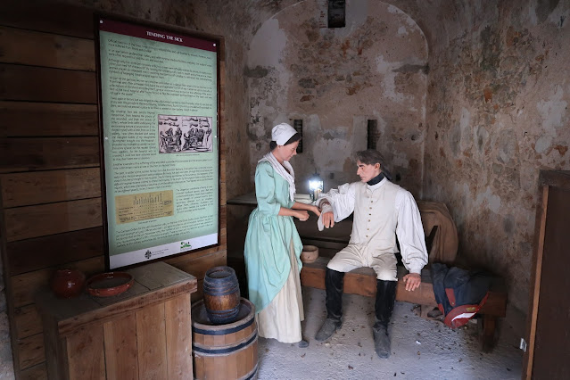 |
| A scene depicting a nurse tending to a sick soldier. While 333 soldiers were killed and 138 disabled by wounds during the Great Siege of Gibraltar, many more suffered from illness and disease. Nursing had not yet become a profession, leaving soldiers' wives to provide what care they could to the sick and wounded using the very limited medical facilities available in Gibraltar. These amateur nurses played an important role in getting sick and wounded soldiers back into the front lines and thereby assisting the garrison to provide a credible defence against the overwhelming numbers of besieging Franco-Spanish forces during the Great Siege. Regular bombardment of Gibraltar by Spanish and French forces caused widespread destruction in the town during the siege, with hospitals filled to capacity with men suffering grievous wounds, often requiring amputation without benefit of anaesthetics. In addition to combat wounds, the generally unsanitary conditions of the time (including crowded living spaces, poor diet, and contaminated water) led troops of the garrison to suffer from a plethora of diseases, such as smallpox, yellow fever, influenza, dysentery, and scurvy. Indeed, on 26 November 1781, out of a total garrison strength of 5,002 officers and men, 557 (11%) were recorded as sick in hospital. Later, on 4 December 1782, the number of soldiers sick in hospital or in their quarters was almost 900, representing one-fifth of the garrison's total strength. |
 |
| Between the two gunpowder magazines is an enclosed courtyard where cannon and mortar rounds were prepared: a shot yard. In the foreground, a soldier of the garrison is shown being whipped for a disciplinary infraction. Under siege conditions, discipline needed to be strenuously enforced to combat the effects of tension, boredom, hunger, and alcohol. Floggings and public executions were regularly carried out in the British Army, with deserters either hanged or tattooed with the letter 'D' on their forehead or branded on their forearm. Flogging was the primary form of corporal punishment in the Army at this time, with sentences of between 100 and 500 lashes regularly given for even the most trivial offences. Salt would be painfully rubbed into the resulting wounds as a means of staving off infection. Flogging was not abolished in the British Army until 1881. Executions were carried out at a number of gallows throughout Gibraltar, with the last public hanging being that of a Private Shaw of the 7th Fusiliers on 8 November 1862. |
 |
| A scene depicting a wagon holding the corpses of two people killed by disease during the Great Siege. Given poor diets and unsanitary living conditions during the Great Siege, disease ran rampant through the garrison and remaining civilian population. By the end of the first year of the siege, smallpox alone had killed over 500 people, with children suffering the highest mortality rate. Shortages of fresh vegetables, fresh meat, and fruit led to an outbreak of scurvy, which was only remedied when a Danish ship carrying lemons and oranges from Málaga sailed too close to Gibraltar and was captured. Gibraltar Governor Lieutenant General Eliott bought the ship's entire cargo of citrus fruit and ordered 60 gallons of lemon juice mixed with 5-10 gallons of brandy, to be administered to scurvy sufferers in doses of 1-4 ounces daily. Although the causes of, and cure for, scurvy were still unknown at this time, the remarkable recovery of those suffering the ailment was remarked upon by a number of observers. |
 |
| A tally of casualties at the end of the Great Siege revealed that while 333 soldiers were killed in combat or died later of their injuries, 536 had succumbed to sickness and disease, not including those who died of scurvy. Although not recorded, civilian casualties are believed to have been even higher, with at least 800 mostly women and children thought to have died over the course of the siege from a combination of disease and malnutrition. |
.jpg) |
| The interior of the small building in the shot yard, which was once a laboratory in which specialised mixtures of gunpowder used in cannon and mortar shells were prepared. During the Great Siege, Captain John Mercier of the 39th (Dorsetshire) Regiment of Foot experimented with various fuses to create shells timed to explode above the heads of Spanish troops, showering them with shrapnel. A Captain Witham invented the first star shell, a shot filled with a special mixture of chemicals that would explode in the air and illuminate enemy positions at night. The ruined shot yard and laboratory building resemble depictions of Gibraltar at the end of the Great Siege in 1783. Although many towers and steeples in the city had been demolished before the bombardment began in order to remove useful aiming points for the Spanish artillery, to reduce damage and injury the British authorities ordered the city's paving slabs to be lifted and the roads ploughed up so that cannonballs would bury themselves in the soft earth rather than ricochet around the streets. Nevertheless, over 400 houses were destroyed by the indiscriminate Spanish bombardment that began on 12 April 1781 and few structures in the settlement survived without suffering some damage. |
 |
| Two mannequins dressed as soldiers of the 72nd Regiment of Foot (Royal Manchester Volunteers), an infantry regiment of the British Army that existed between 1777 and 1783. The regiment was formed on 16 December 1777 in the City of Manchester to serve on garrison duty in Gibraltar during the American Revolution. Following signature of the Treaty of Paris (3 September 1783) that ended the American Revolutionary War, the 72nd Regiment returned to Manchester and was disbanded. |
 |
| A North African trader selling fresh vegetables to the garrison of Gibraltar. Spain's closure of the border on 20 June 1779 and its use of naval vessels to prevent supplies and reinforcements from reaching the British was designed to starve the garrison into submission. Civilians were encouraged to leave Gibraltar and Governor Eliott experimented with the minimum amount of rice required to sustain a man each day, in order to preserve the dwindling stocks of food. He even went so far as to order the soldiers to stop powdering their wigs with flour, as was the custom, to make the flour supplies last longer. The indiscriminate bombing of the town by Spanish artillery commencing on 12 April 1781 exposed supplies of food and liquor stockpiled by the town's wealthy inhabitants. This resulted in a wave of looting by hungry and thirsty soldiers until Governor Eliott issued a Garrison Order on 26 April declaring that any soldier found drunk or asleep at his post or found marauding should be immediately executed. Soaring prices for even poor quality food led to North African traders smuggling supplies across the Strait of Gibraltar, past the Spanish naval blockade. When the smuggling routes from the Barbary Coast were cut off, local blockade runners sailed as far away as Minorca, Oran in Algeria, or Portugal to obtain supplies. Despite these efforts, there was never enough food to satisfy demand, and the remaining civilian populace was forced to eat grass, seaweed, and wild onions when conditions worsened. Soldiers in the garrison were charged exorbitant prices by traders for these smuggled goods, with a cabbage costing 2.5 days' pay and the head and feet of a sheep selling for more than three weeks' wages. |
 |
| The south gunpowder magazine, now converted into a small theatre showing a looped film about the Great Siege of Gibraltar. |
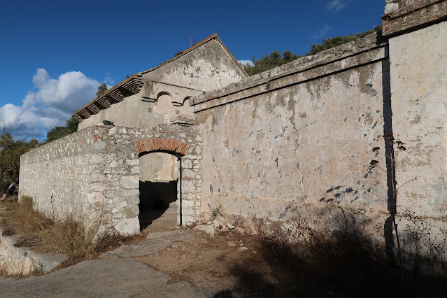 |
| The high walls enclosing Old Willis's Magazine were built later, most likely around the time of the Great Siege. Records from prior to 1779 show the gunpowder magazines and the laboratory building as separate and not enclosed within any walls. |
 |
| Located on Willis's Road, near the City Under Siege exhibition, is a restored lime kiln. It is one of two such kilns on Gibraltar, the other being on the eastern coast near Catalan Bay. Built in the late 1800s or early 1900s, this kiln was used to produce quicklime for use in the construction of water catchments and underground reservoirs. Quicklime was produced by burning limestone in the kiln at temperatures above 900°C (1,652°F), using coal as the fuel. The end product of this process was a corrosive substance that was mixed with water to produce 'slaked lime'. This slaked lime was used to line the insides of underground cisterns, which prevented bacterial growth in the stored water. Additionally, slaked lime formed the basis of mortars and cement, and was also a key ingredient in making whitewash. The kiln is built out of limestone blocks with an interior lining of heat-resistant bricks. The rough nature of the outer limestone blocks suggests that this kiln may have been a temporary structure, perhaps used to produce the quicklime needed to whitewash the large area of nearby rock that had been stripped of vegetation and prepared as a rainwater catchment basin. Additionally, quicklime produced here might have been used to whitewash the reservoir and tunnels where rainwater collected by catchments on Gibraltar's eastern slopes was stored. Old railway tracks leading from the kiln are still visible and may have led to the town's waterworks. |
Moorish Castle
 |
| Perched on the northwest corner of the Rock is the Tower of Homage, the most recognisable part of the Moorish Castle, which comprises assorted buildings, gates, and fortified walls extending down the side of the cliff. Originally, the castle was linked to individually-fortified districts stretching all the way down to a dockyard at the port, where Grand Casemates Square sits today. Also known as the Calahorra, the Tower of Homage stands 23 metres (75.5 foot) tall and is located 100 metres (328 feet) above sea level, making it the highest Islamic tower of its type in the Iberian peninsula. It has a footprint of 320 square metres (3,444.5 square feet). Over the course of its existence, the Tower of Homage has withstood ten sieges of Gibraltar. |
 |
| Although troops of the Umayyad Caliphate under the command of Ṭarik ibn-Ziyad landed at or near Gibraltar in 711 to begin the Muslim conquest of the Iberian peninsula, it was not until 1160 when a permanent Moorish settlement was established on Gibraltar at the direction of Abd al-Mu'min of the Almohad Caliphate. This settlement was named Madīnat al-Fath ('City of Victory') and included a fortress with a tower. The Moors ruled over Gibraltar until 1309, when it was seized by the Kingdom of Castile after a short siege; however, in 1333, the Moors of the Marinid Sultanate recaptured Gibraltar, during which the fortress's original tower dating from 1160 was nearly destroyed. The present Tower of Homage was built by the Moors around the ruins of the original tower, but made larger and stronger than its predecessor. The east face of the tower, seen here, still bears the scars of the 1333 siege, being peppered with cannonball impact craters. The white patches on the tower's exterior are the remains of a lime whitewash applied by the Spanish during the 16th century (following Spain's recapture of Gibraltar in 1462), when the structure was known as the Torre Blanca ('White Tower'). The crenellations and arrow slits along the tower's terrace are reconstructions completed in the 1970s. |
 |
| A Mediterranean style garden in front of the Tower of Homage. |
 |
| Situated just east of the Tower of Homage and adjacent to the walkway leading into the tower is Queen Charlotte's Battery, originally built in 1727. As part of the 1732 renaming of Gibraltar's artillery batteries after members of the Royal Family, this battery was named after Queen Charlotte (1744-1818), wife of King George III. It is a 'retired' battery, meaning that it was placed far from the harbour. Being built higher up on the Rock made the guns less vulnerable to enemy fire and gave the battery's guns greater range compared to guns built at sea level. |
 |
| The current entrance to the Tower of Homage. This entrance was created by the British in 1727 to extend the Moorish Castle's northern defences. Originally, this rear side of the tower featured an arched sally port two-thirds up the wall, connected to a wooden walkway to facilitate defence of the tower's base. The sally port was bricked-up long ago, though its remains can still be seen on the exterior of the tower. |
 |
| Inside the tower's entry passageway en route to the central staircase. The solidity of the tower's thick walls is evident, having been crafted from tapia, a type of cement made with crushed pottery or pumice, mixed with limestone and/or marble chips, and held together by lime and red sand mortar. This cement was moulded in frames, making it very hard and capable of withstanding significant punishment from cannon fire. |
 |
| Looking down a modern steel staircase that has replaced the vaulted spiral staircase that used to provide the only access down and out to the inner keep of the castle during the Islamic and Spanish periods. This vaulted staircase, the remains of which are still evident, ascended the tower in a clockwise direction around a central open shaft that allowed defenders to have a clear swing at attackers using their sword arms, while the attackers would have a more difficult time parrying these blows. |
 |
| The top floor of the Tower of Homage. The tower was designed to provide protection for a limited period of time in the event of a prolonged siege. As a place from which to make a last stand against attackers while awaiting the arrival of reinforcements, extensive living quarters were not included. Instead, the tower was outfitted with armouries, bathing facilities, a cistern, and ovens. The circular sockets above the doorways seen here would have taken pivots for large doors. |
 |
| The floor tiles in this chamber date from the 14th century, as does a cistern which collected rainwater via a series of clay pipes from the tower's roof. |
 |
| The windows in the Tower of Homage have been expanded in recent times from their original size. A defensive tower would not have featured such large windows, which would have represented a vulnerability to those sheltering inside. |
 |
| This chamber, with fine plaster ceiling mouldings, was likely used as a prayer room during the Islamic period and was later converted into a Christian chapel under the Spanish. The bricked-up arched doorway at the end of the chamber was once a sally port for soldiers to access a wooden walkway on the exterior of the tower. In 1462, the bones of Don Enrique Pérez de Guzmán, 2nd Count of Niebla, were laid to rest in the chapel many years after he and many of his knights had drowned in 1436 during an attempt to recapture Gibraltar from the Moors. Don Enrique's body had been recovered from the water by the Moors occupying Gibraltar and was said to have been hung over the city walls as a warning against further attacks. It had only been possible to lay Don Enrique's bones to rest after his son, the Duke of Medina Sidonia, captured Gibraltar from the Moors in 1462, ending over 700 years of Muslim rule. |
 |
| Notable in the tower's history are two events during the last period of Spanish rule of Gibraltar, between 1462 and 1704: in April 1466, Esteban de Villacreces, commander of the Gibraltar garrison, sought refuge in the Tower of Homage for the last five months of a 16-month siege by forces under Juan Alonso de Guzmán, the 1st Duke of Medina Sidonia. This ninth siege in Gibraltar's history was prompted by the Duke's support for a contender to the throne of the Kingdom of Castile. Esteban and the remaining members of the garrison surrendered in June 1467. Later, on 10 September 1540, several hundred residents of Gibraltar sought refuge in the Tower of Homage during an attack by Turkish pirates, who landed at the undefended Europa Point and proceeded to loot and ransack the city. |
 |
| Although this part of the tower has been heavily remodelled, historical records and ceiling mouldings suggest this area originally consisted of three rooms. Archaeological evidence suggests that the area was used for bathing and washing. The low doorways were designed to retain heat from the bath. |
 |
| Looking inside the remnants of the tower's bath. There was a room that held the furnace and hot water and another room for washing. A cupola ceiling with holes cut through it was designed to let steam escape, while floor canals channelled bath water to the tower's exterior. |
 |
| A computer reconstruction of what the bathing rooms might have looked like, as described in Lieutenant Colonel Thomas James's 1771 chronicle, History of the Herculean Straits. |
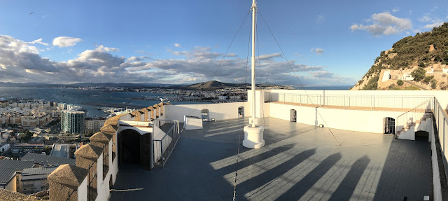 |
| The roof of the Tower of Homage. It was here, according to Gibraltar's first historian, Alonso Hernández del Portillo (1543–1624), that a bell was installed, to be rung upon sight of an approaching enemy. The sound of the ringing bell would signal the town's populace to flee the city and seek shelter in the tower. |
 |
| The key-and-castle Gibraltar flag flies from the top of the Tower of Homage today. In 1704, Admiral Sir George Rooke hoisted the British flag atop the Tower of Homage after Gibraltar's capture by Anglo-Dutch forces during the War of the Spanish Succession. |
 |
| Looking southwest from the roof of the Tower of Homage, toward Gibraltar's harbour and the Bay of Gibraltar beyond. |
 |
| A final look at the Moorish Castle and its Tower of Homage. Although the tower has been a tourist attraction for many years, other parts of the castle complex housed Gibraltar's prison until 2010, when the prison was moved to a new facility on Windmill Hill in the south of the peninsula. |
Mediterranean Steps
 |
| Although many visitor guides describe climbing up the Mediterranean Steps, climbing down from the Upper Rock is less tiring and allows the visitor to better appreciate the scenery. The top of the Mediterranean Steps is seen here, located off O'Hara's Road near O'Hara's Battery in the southern extremity of the Upper Rock. Seen far below to the west is the southern part of the city and harbour, with the Bay of Gibraltar beyond. |
 |
| A sign at the top of the Mediterranean Steps shows the 1,800 metre (5,905.5 foot) route winding down the eastern and southern faces of the Rock, as well as some of the sights hikers may come across during their journey. Starting at 426 metres (1,397.6 feet) above sea level, this hike will end at Windmill Hill, 180 metres (590.5 feet) above sea level, representing a descent of 246 metres (807 feet). |
 |
| Looking north along the eastern face of the Rock of Gibraltar from the top of the Mediterranean Steps. Located very near these steps are the remains of a secret underground bunker constructed by the British in 1941-42 under Operation Tracer. In the event of a German invasion of Gibraltar, Operation Tracer--the brainchild of Rear Admiral John Godfrey, the British Admiralty's Director of Naval Intelligence--would have seen a volunteer team of six British servicemen left behind, sealed inside the bunker for a year but with enough supplies to last up to seven years. This team, comprising an officer in command, three radio operators, and two physicians, would have secretly observed Axis naval movements around Gibraltar through small apertures excavated in the rock faces overlooking the Bay of Gibraltar and the Mediterranean. The team would have radioed reports of these Axis movements to Allied forces using retractable aerials extended out of the apertures. Although the six men resided undercover in Gibraltar for two and half years awaiting the signal to deploy into their bunker, Operation Tracer was never activated due to the waning fortunes of the Axis powers and Nazi Germany's abandonment of its 1940 plan to invade Gibraltar (Operation Felix). With Operation Tracer shelved, Rear Admiral Godfrey ordered the stockpiled supplies distributed and the bunker sealed up, while the six-man team was disbanded and the men returned to civilian life after the war. Although the plans for Operation Tracer were hidden away as Top Secret, rumours of an alleged wartime 'Stay Behind Cave' circulated in Gibraltar for decades after the war. However, it was not until 1997 that the bunker was discovered by the Gibraltar Caving Group and authenticated in 1998 by one of the bunker's builders and, in 2008, by the last surviving member of the six-man Tracer team. |
 |
| Descending the Mediterranean Steps from the summit, 400 metres (1,300 feet) above ground. The narrow, uneven limestone steps cut into the cliff face of the Rock can make for a challenging hike, whether ascending or descending. |
 |
| The Mediterranean Steps were originally constructed by the British Army to link various outposts and artillery batteries at the southern end of the Upper Rock. Having fallen into disrepair by the 2000s, the Government of Gibraltar, the Gibraltar Ornithological and Natural History Society, and the Bonita Trust partnered to restore the Mediterranean Steps in 2007. The trail is now open year-round and is a popular tourist attraction. |
 |
| The zigzag steps descend the eastern side of the Rock, with the Mediterranean Sea far below. |
 |
| Visitor guides warn of the risk of vertigo as one climbs up or down the steep, uneven steps. |
 |
| The scrubby vegetation and lack of much shade makes for a hot and tiring walk at midday. Many visitors choose to tackle the Mediterranean Steps early in the morning, before the midday sun, or in the afternoon when the eastern side of the Rock is in shade. |
 |
| While the trail is equipped with rope railings to guide hikers, steep slopes drop off on the other side of the ropes. |
 |
| Looking up the steps during the descent. Native fan palms and other scrubby Mediterranean plants cling precariously to the cliff face, anchored in rocky crevices. |
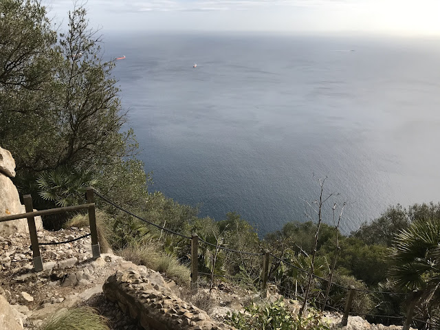 |
| Looking east, over the Mediterranean. |
 |
| Stanchions and a rope railing guide the way down the narrow, rocky steps. The terrain drops away steeply to the left, with the eastern face of the Rock on the right. |
 |
| The steps turn into a rough gravel track through dry, scrubby brush at this point. |
 |
| Heading south along the trail. Wild olive (Olea europa) is the dominant shrub of the dense, scrubby habitat covering much of the Upper Rock. The Wild olive is the ancestor of the olive, which forms an important part of Mediterranean cuisine. |
 |
| A lookout provides an opportunity to rest and enjoy the view out over the Mediterranean. |
 |
| The craggy limestone eastern face of the Rock looms overhead. |
 |
| Scuttling about in the underbrush is a Barbary partridge (Alectoris barbara), a species found only in North Africa, Sardinia, and Gibraltar. Although favouring more open habitats, the Barbary partridge is equally at home in the type of thicker scrub dominating much of the Upper Rock. |
 |
| Looking north, with the whitewashed houses of Sandy Bay far below. |
 |
| The gravel trail continues south, with the slope falling away sharply on the left. |
 |
| The trail resumes its descent via steps cut into the rock. Europa Advance Road can be seen below, hugging the contour of the eastern coast. At the curve in the road is the interpretation centre and viewing platform for the Gorham's Cave Complex UNESCO World Heritage Site. This complex of four caves on the eastern side of Gibraltar contains archaeological and palaeontological artefacts proving that Neanderthals occupied this site over a span of more than 100,000 years. A strict annual visitor quota has been established to avoid damaging the caves, so the interpretation centre and viewing platform allows visitors to see and learn about the caves without risk of destroying the priceless Neanderthal rock engravings and other cultural evidence. |
 |
| The trail passes through a tunnel of shrubs and trees. |
 |
| A profusion of Wild olive trees and European fan palms (Chamaerops humilis) line this section of the trail. |
 |
| An abandoned Second World War military fortification, one of several along the Mediterranean Steps. |
 |
| Inside the concrete bunker, which once would have housed guns or sighting equipment to help defend the eastern side of Gibraltar. |
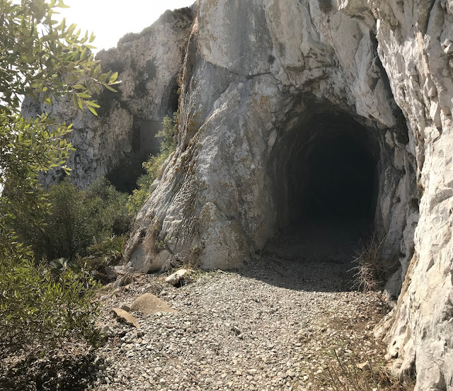 |
| The trail continues into a tunnel cut through the limestone cliff face of the Rock. |
 |
| Inside the short tunnel through which the Mediterranean Steps trail takes hikers. |
 |
| The rationale for the tunnel's construction is evidenced by the craggy, vertical limestone cliffs dropping to the sea below. |
 |
| A thicket of Opuntia cactus, also known as prickly pear, growing among the limestone crags along the trail. |
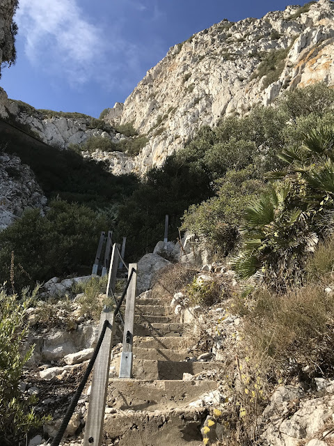 |
| Looking up the steps after another descent. The limestone massif of Gibraltar towers overhead. |
 |
| The bright blue waters of the Mediterranean peak through a gap in the vegetation as the Mediterranean Steps continue downwards. |
 |
| A series of wooden retaining walls along this level section of trail hold back loose rock from cascading into the sea below. |
 |
| The trail here slopes gently downwards, though the path is more of a rough rock scramble requiring hikers to pick their way carefully between uneven crags and boulders. In the distance can be seen the blue-and-green surface of the Lathbury Sports Centre, located on the upper southern plateau called Windmill Hill. |
 |
| A panoramic shot of Windmill Hill, the upper plateau at the southern end of Gibraltar which sits above Europa Point. Dominating Windmill Hill is the new Lathbury Sports Complex, inaugurated on 6 June 2023, with its blue running track and green athletics field. The facility also features a 52 metre Olympic-sized swimming pool, conference and media rooms, an underground car park, and seating for 794 outdoor and 288 indoor spectators. It is named after the Lathbury Barracks, which once sat on this site. The long building on the left is His Majesty's Prison (HMP) Windmill Hill, Gibraltar's only prison. |
 |
| As it descends to its lowest reaches, the Mediterranean Steps merges with Martin's Path, where the vegetation is more dense and lush, such as this stretch through a tunnel of trees. |
 |
| An observation deck near the base of the Mediterranean Steps is home to the Pillars of Hercules monument, a popular location for tourists to snap photos of their visit to Gibraltar. This side of the monument depicts the Ancient World, centred on the Mediterranean Sea. The two classical pillars are wrapped in scrolls, one reading 'Mons Calpe' (the ancient Roman name for Gibraltar) and the other 'Mons Abila' (referring to either Monte Hacho or Jebel Musa on the African side of the Strait of Gibraltar). The plaque at the monument's base reads, 'To the Ancient World Gibraltar was known as Mons Calpe, one of the legendary pillars created by Hercules, as a religious shrine - and as an entrance to Hades. To many, it signified the "non plus ultra", the end of the then known world.' |
 |
| The other side of the monument depicts the Modern World, with Gibraltar shown at the centre and distances to some major world cities shown. The plaque on this side of the monument reads, 'In modern times Gibraltar is famous as an important tourist, trading and financial centre created by the enterprise and initiative of its citizens. With a unique position at the crossroads of land and sea routes where the east meets the west.' |
 |
| The start or, in this case, the end of the Mediterranean Steps on Windmill Hill Road. |
Jews' Gate Cemetery
 |
| The entrance to Jews' Gate Cemetery on Windmill Hill Road, just south of the entrance to the Mediterranean Steps and the Pillars of Hercules monument. A wash basin and water tap at the entrance permits visitors to wash their hands, in keeping with Jewish ritual. With the Inquisition raging in nearby Spain in the 18th century, the Jews of Gibraltar petitioned the Governor for a plot of land for a Jewish cemetery, to be located as far away from the Spanish mainland as possible. The reason for requesting a southern location could also have been influenced by concern over the potential future surrender to Spain of land north of the Rock. In such a situation, a Jewish cemetery in the northern district could have found itself part of Spain, in which the 1492 Decree of Expulsion prohibiting Jews (alive or dead) from residing in Spain was still in force. While the precise date of the cemetery's establishment is not recorded, it dates to at least 1726. |
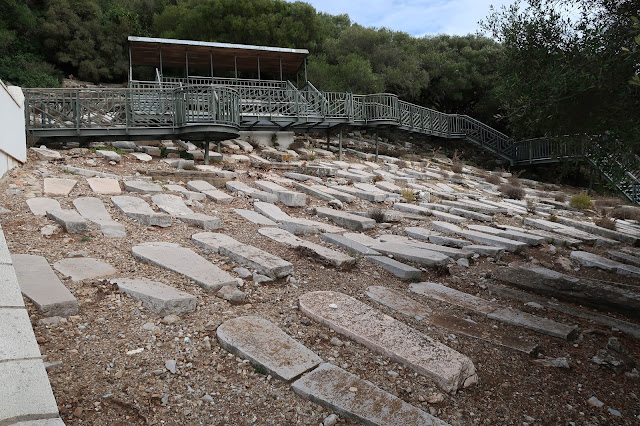 |
| Jews' Gate Cemetery is the final resting place for a number of Gibraltar's Chief Rabbis and Dayanim (religious judges) in the 18th and early 19th centuries. The gravestones are mainly horizontal, in the Sephardic style. A recent topographical survey of the cemetery has revealed in excess of 800 graves, with indications that additional graves may be located at the south and west extremities of the cemetery. A modern, raised walkway now weaves through the cemetery to permit people to visit without stepping on the gravestones or risking a fall on the steep and uneven hillside. |
 |
| With Gibraltar becoming increasingly fortified in the 19th century, Jews' Gate Cemetery found itself within the boundaries of the Rock's military zone, closed to the public. At the recommendation of military authorities, the cemetery was closed for further burials in May 1848 despite protests and petitions from Gibraltar's Jewish community. In a 31 May 1848 letter from Britain's Colonial Secretary, it was decreed that 'all future Hebrew dead shall be deposited in the allotted portion of the New Cemetery'. After that time, Jews have been buried in a Jewish section of the North Front Cemetery, near what is today the airport runway. As a concession to Jewish families with ancestors buried in Jews' Gate cemetery, military authorities issued a special permit to allow visitation of the cemetery on one day of the year, Lag BaOmer, the Jewish equivalent of All Saints Day. This continued for as long as the Upper Rock remained an active military zone. |
 |
| By the early 1980s, when the Upper Rock finally began to be demilitarised, Jews' Gate Cemetery was almost totally overgrown with vegetation after years of neglect. A handful of graves were uncovered and cleaned, which led to the discovery of yet more graves. Although most of the gravestones have been rendered illegible or have crumbled after more than 200 years of exposure to the elements, those gravestones that had been covered over with mud and peat were well-preserved and their inscriptions remain legible. After an extensive restoration and clean-up, and the installation of the raised walkway system, Jews' Gate Cemetery was rededicated on 31 May 2015. |
 |
| Jews' Gate Cemetery is the favoured mating ground of the rare Barbary partridge. At the request of the Gibraltar Ornithological & Natural History Society, the scrubby native vegetation is allowed to grow over the gravestones during the winter and spring months and is only cut back after nesting season is over. |
One final look at Gibraltar from high atop the Rock...


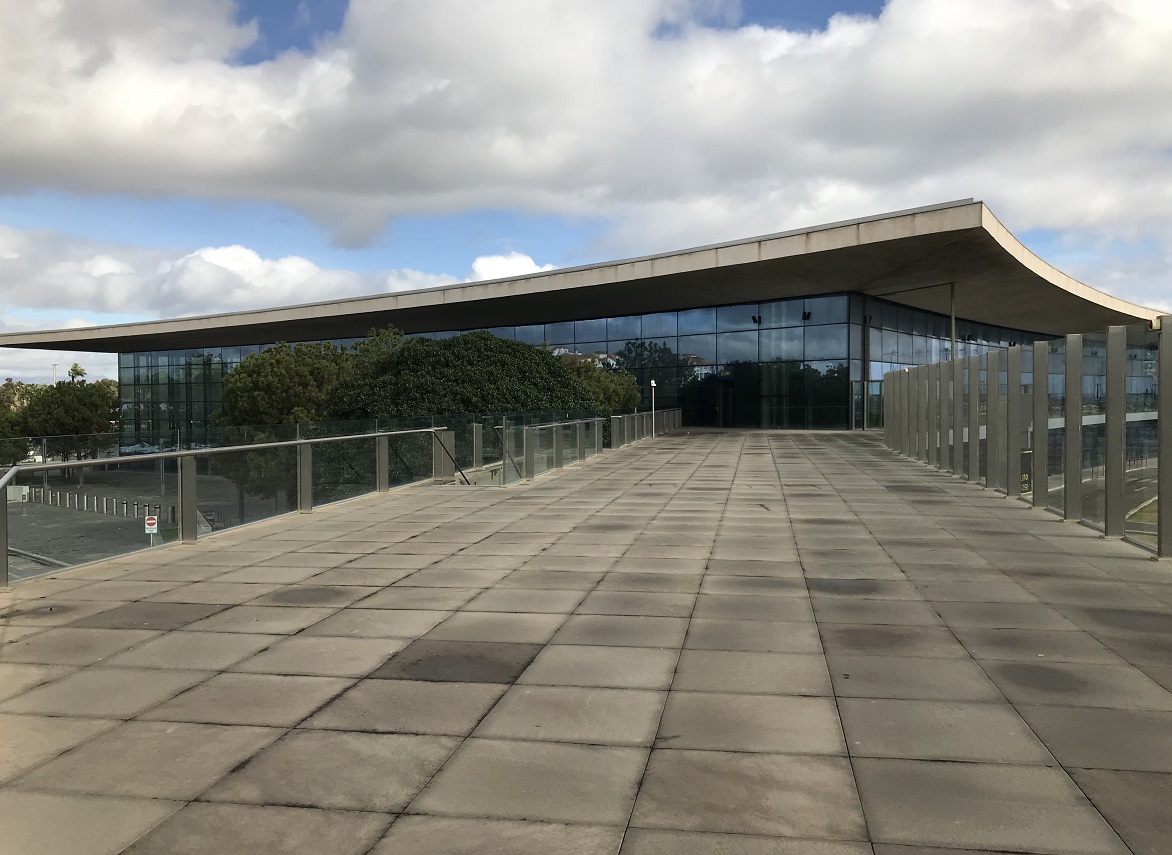


.jpg)


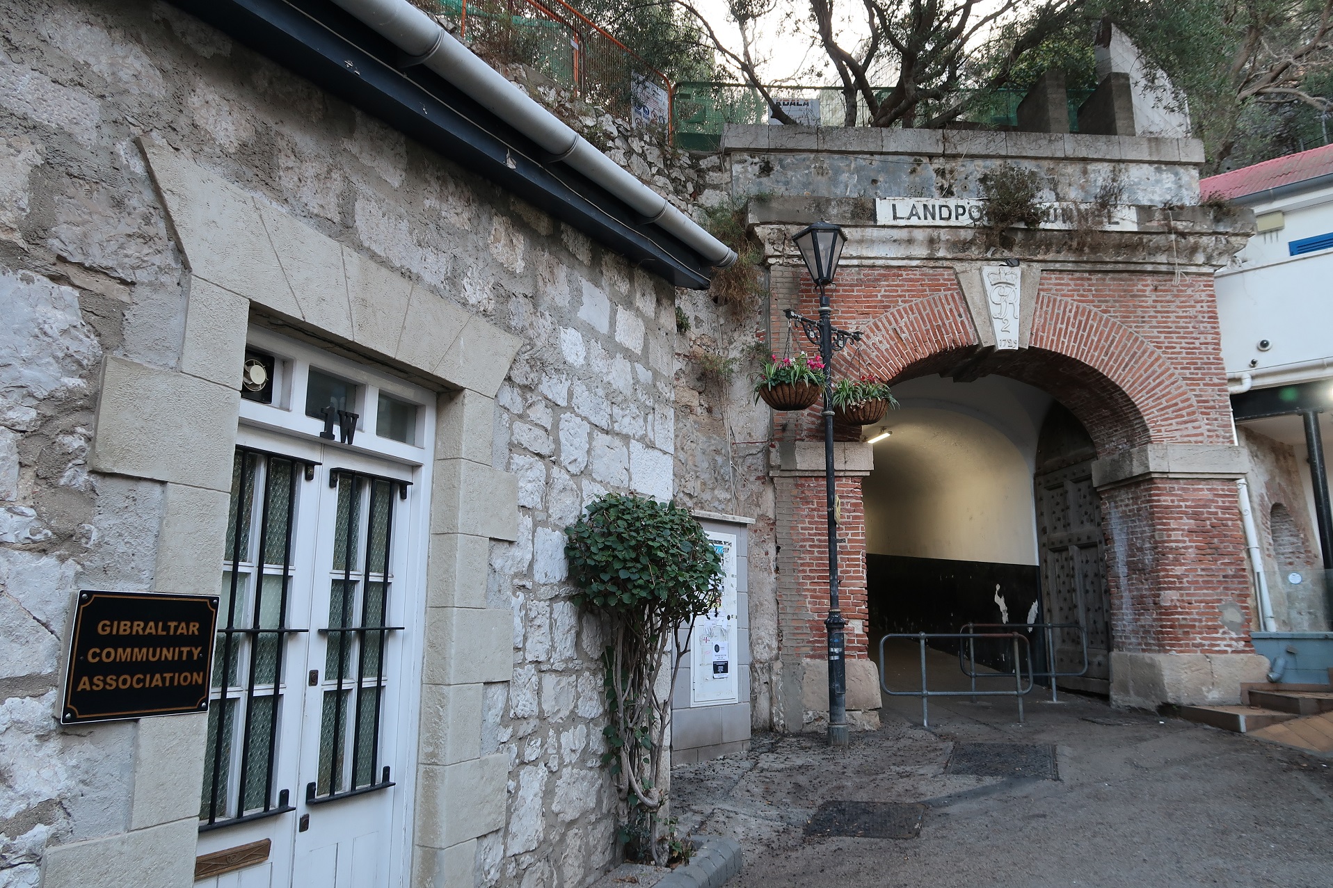


.jpg)


.jpg)


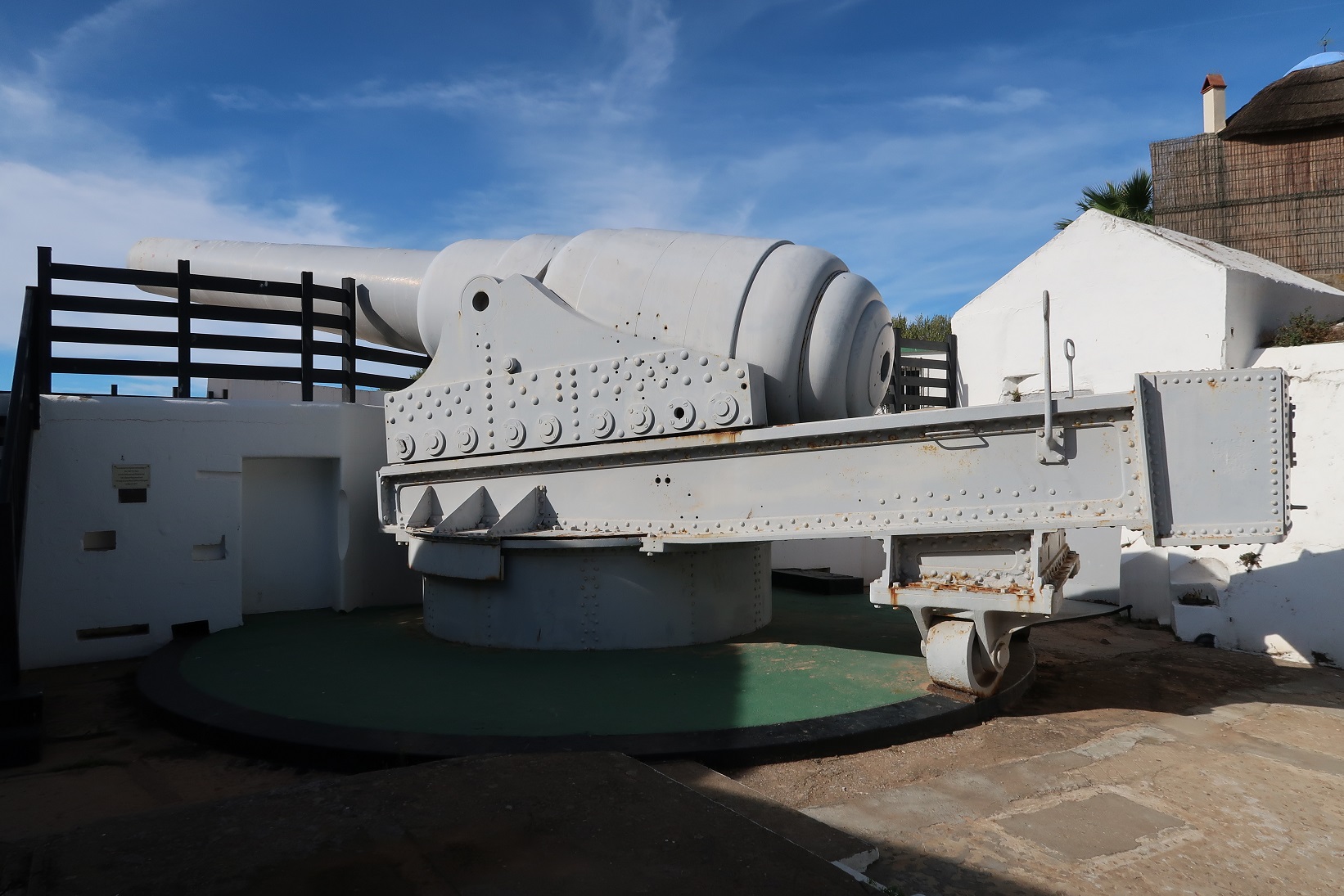


.jpg)


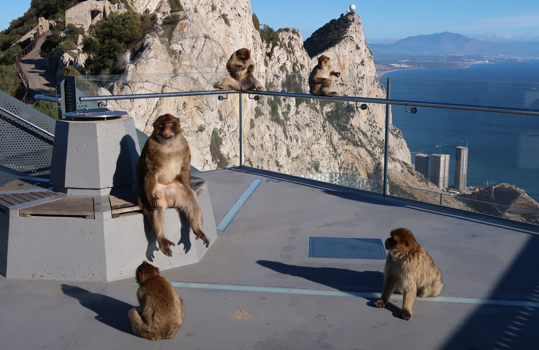


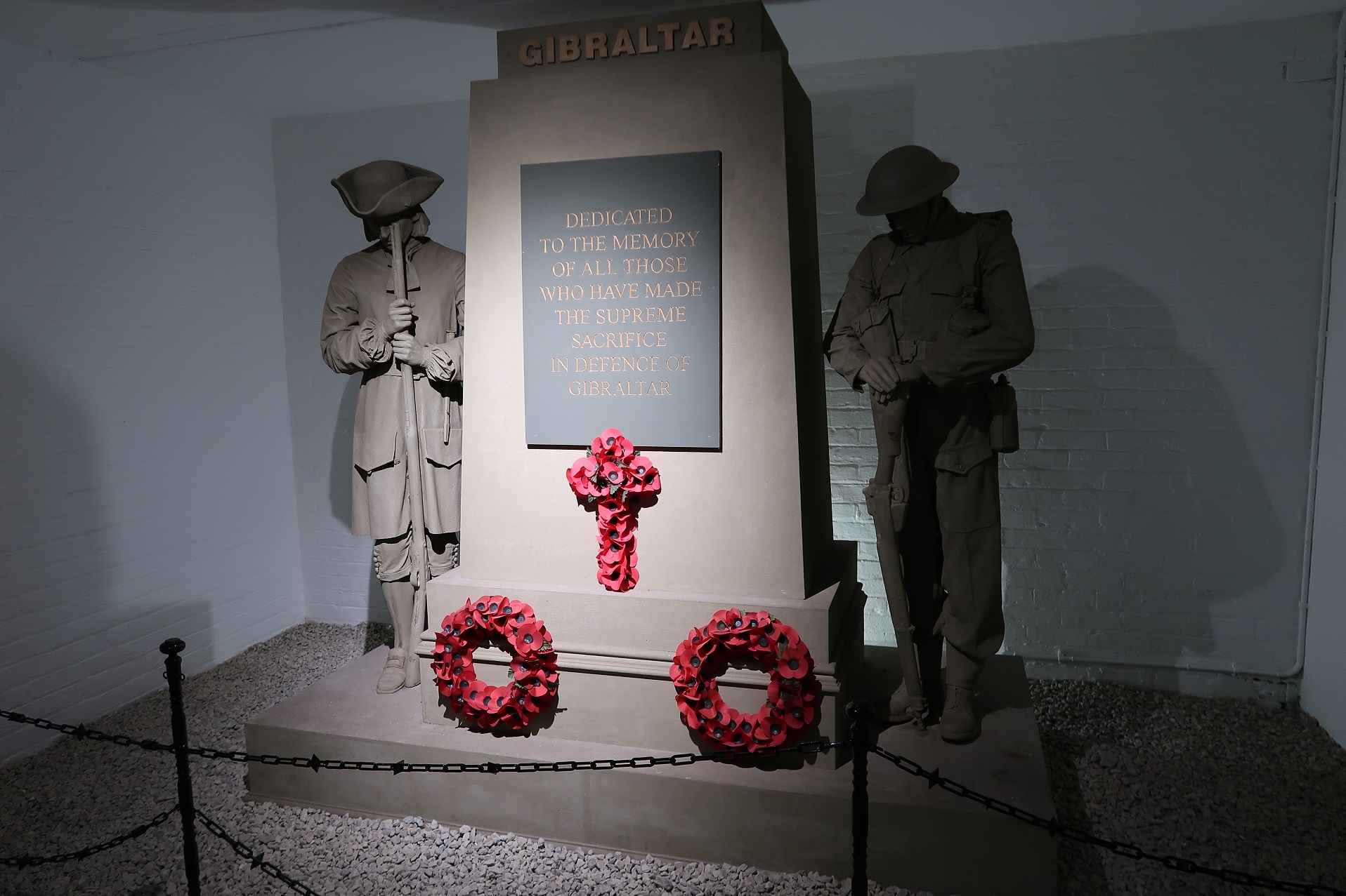


.jpg)